Great Britain Bike Tour: Part 6 (Tiny Horses to Bristol)
August 14, 2023
A month on our bicycles, unsupported, spanning the entire isle of Great Britain. Three countries. Five major cities. Tens of thousands of feet of incline. 800ish miles. Literally millions of sheep.
If you missed the previous post, you can find Part 5 here.
In this post, we'll travel from some tiny horses we met in Wales all the way back into England, to Bristol. We found the bicycle infrastructure between Cardiff and Bristol... wanting, though we were pleased to discover a very large bicycle path on a very large bridge. More on that later.
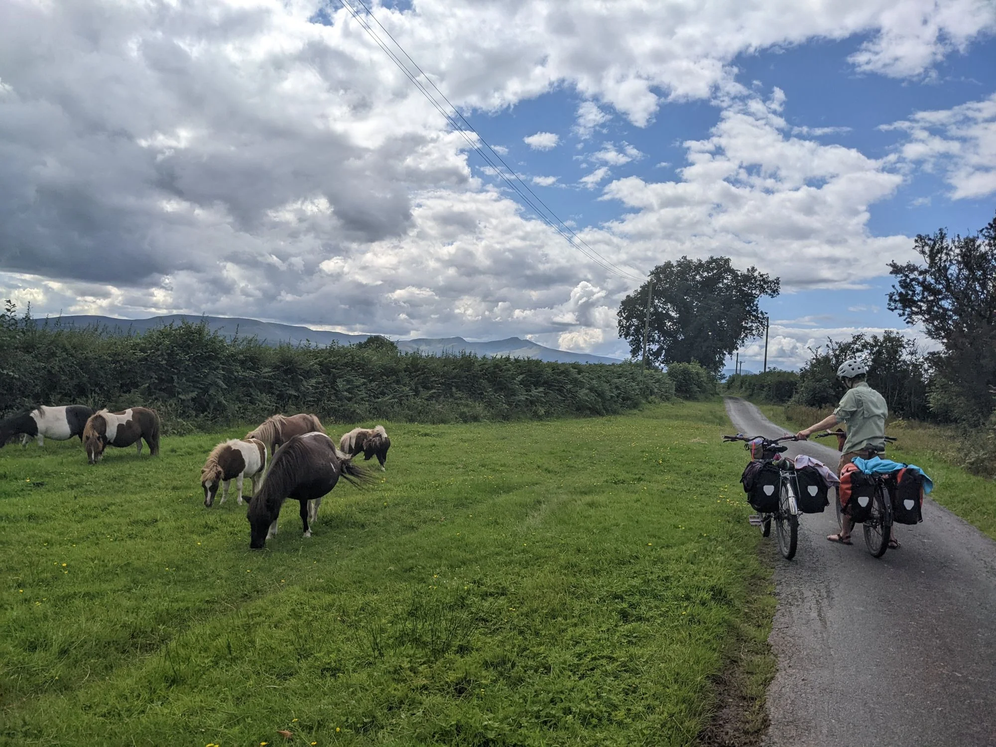
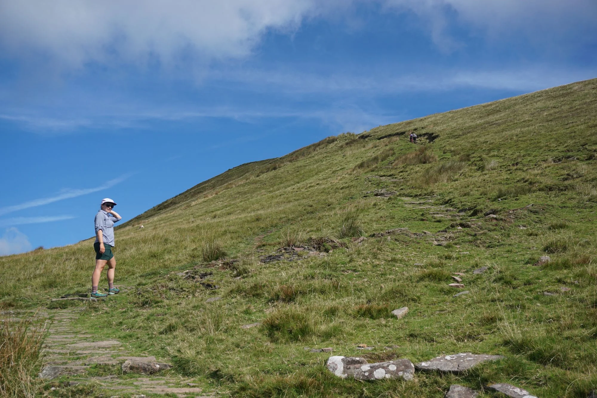
Our journey resumes right at the top of a brutal hill. Our heroes, Nate and Meg, were almost without hope. Their bicycles were squeaking. Their legs were aching. Their palms were sweaty. Mom's spaghetti. Wait, no, that's not right. We just stumbled upon some very cute tiny horses, had a quick snack, and drank some water.
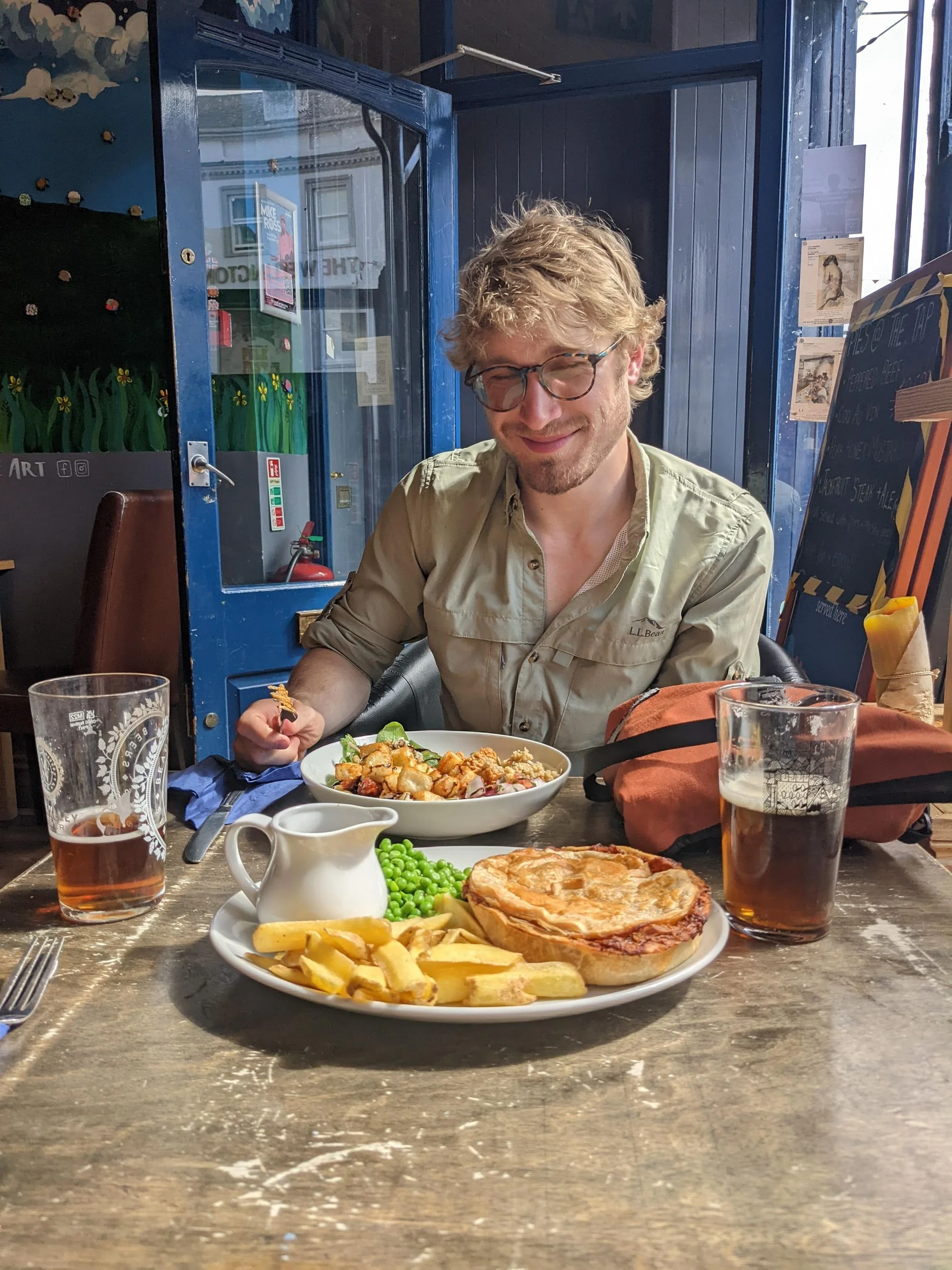
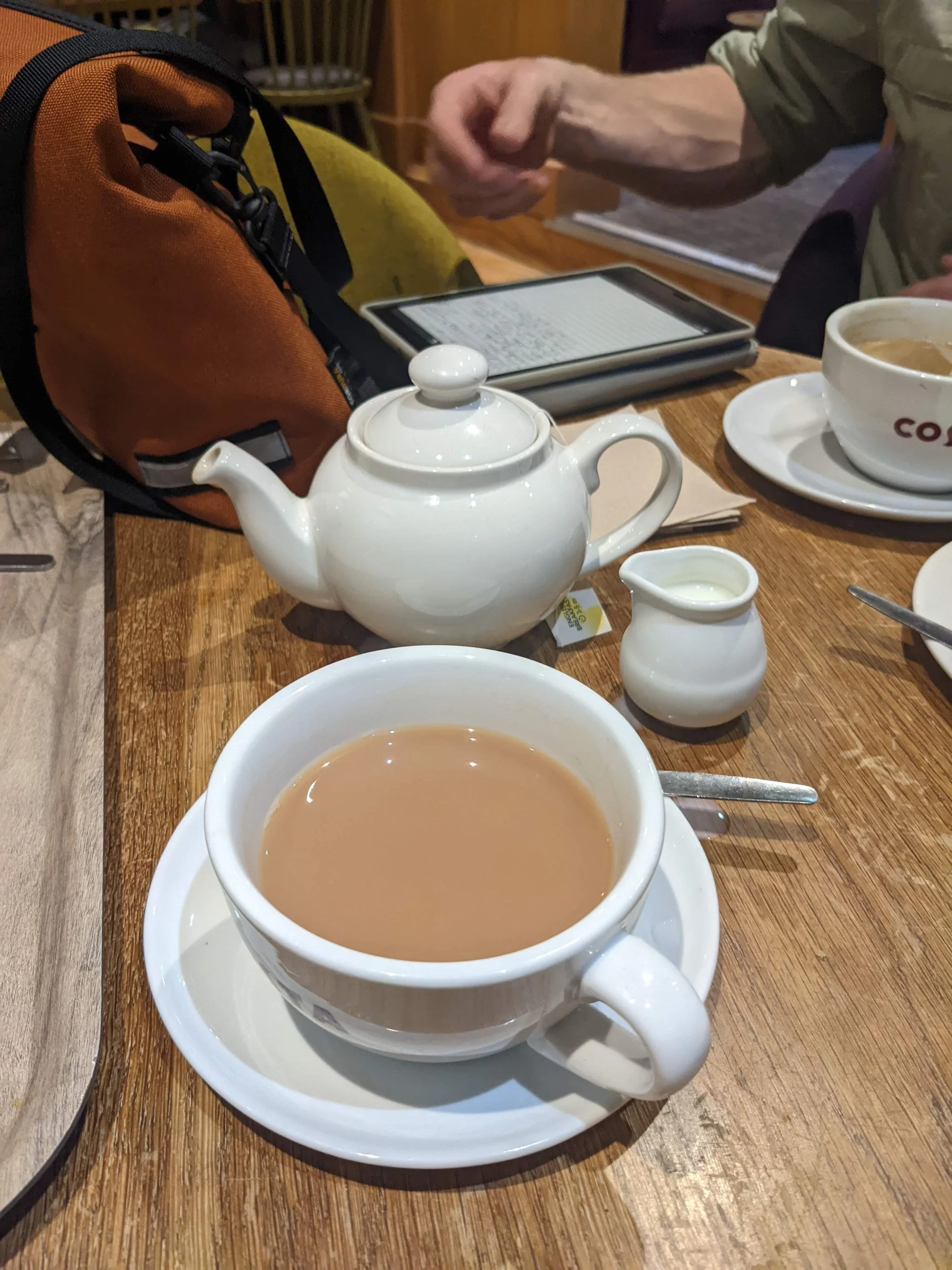
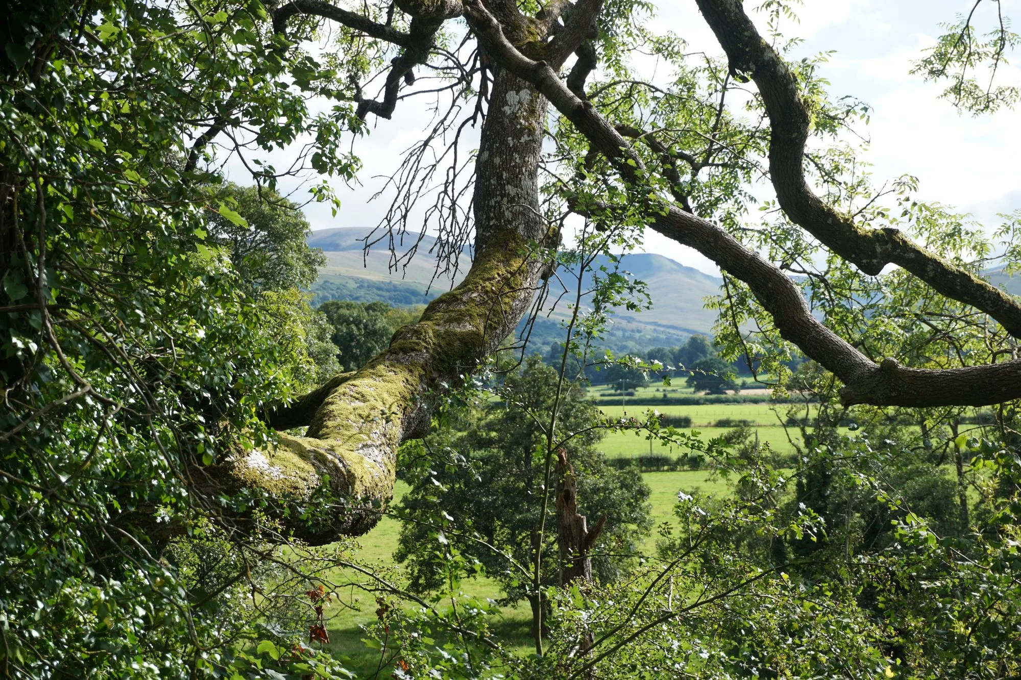
Then it turned out we were at the top of a very long uphill, so we cruised downhill through a very pleasant breeze, with some great views of the Brecon Beacons, to lunch at the Brecon Tap. We had a refreshing pint, a life-replenishing pie, and something that the menu called a salad that I'm not sure legally conforms to that description. But it was all very tasty, and the rest was much needed. Then we popped over to a Costa Coffee for a caffeine pick-me-up and a quick phone charge while we scouted out a campsite.
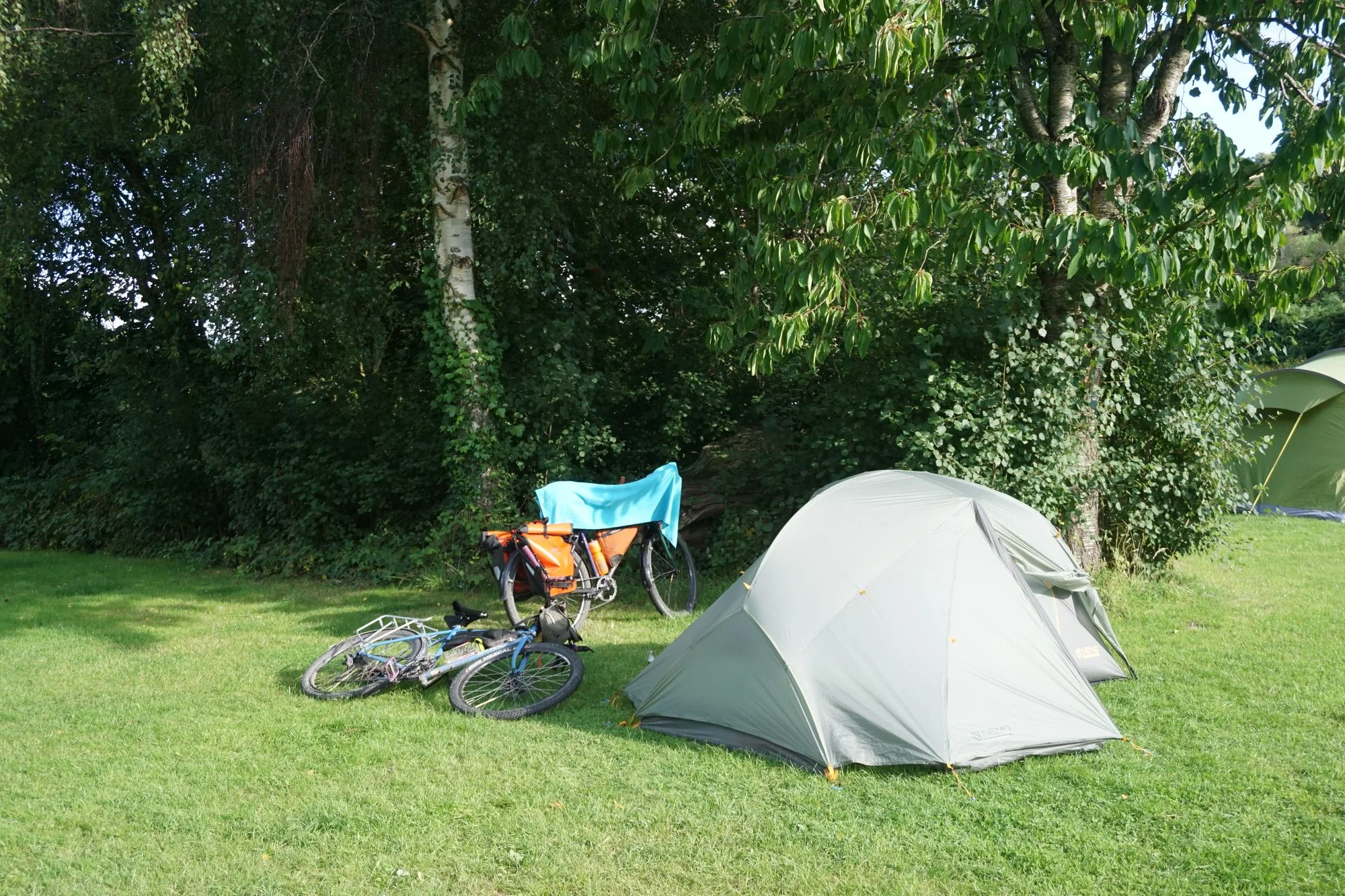
We found a decent campsite with prominent quiet hours and a lot of impressive-sounding awards. A short shopping trip to the co-op for local cider, then a couple hours of easy mild uphill riding later, we arrived at our campsite with plenty of time to spare before sunset.
We showered, set up the tent, enjoyed a refreshing beverage, and passed out due to lack of sleep well before the sun went down. I am happy to report that the quiet hours were absolutely followed, though it probably helped that we camped as far away from other people as possible after the previous night's trauma.
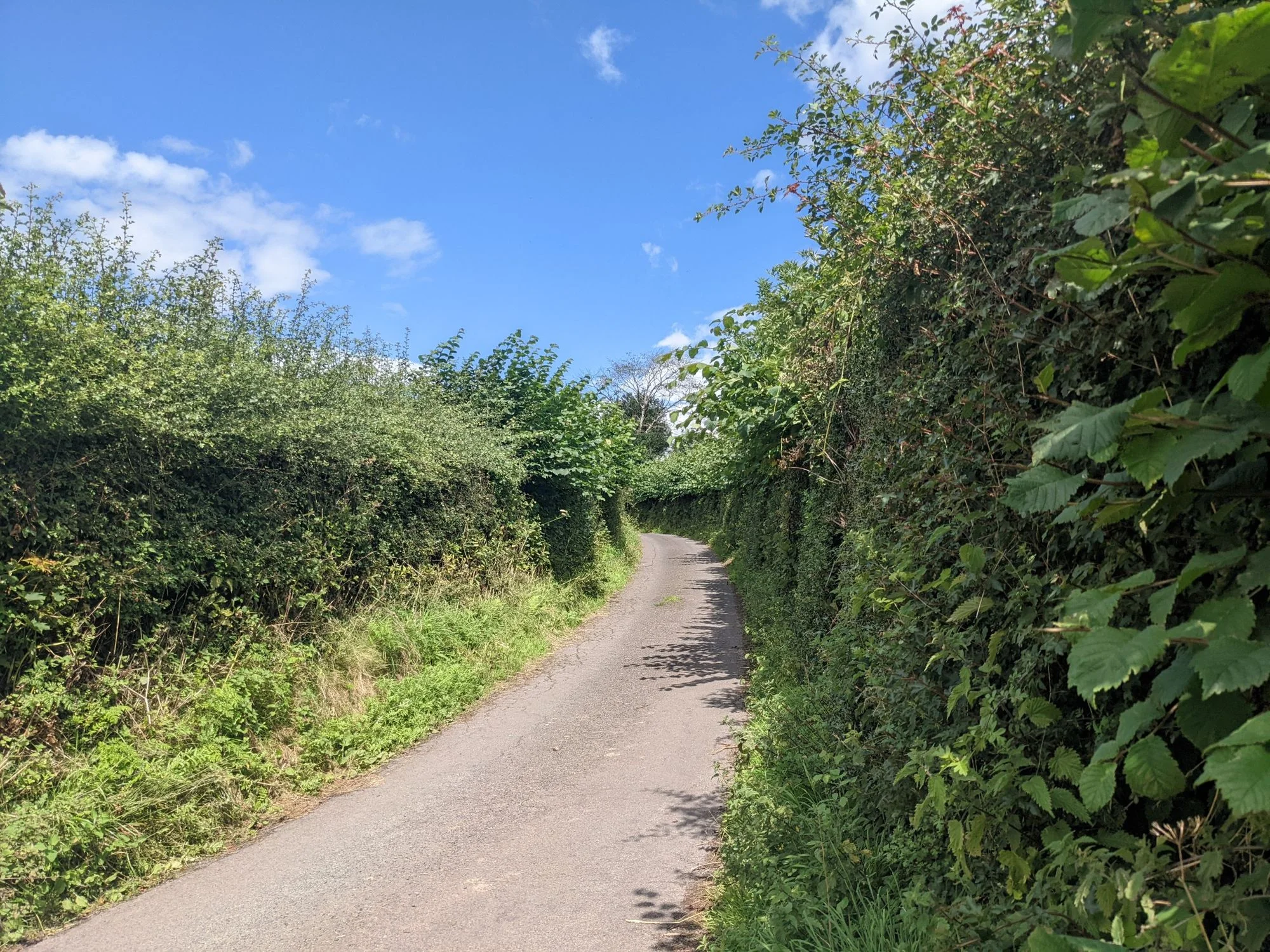
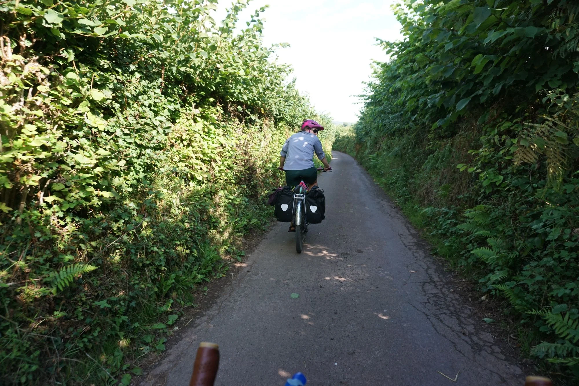
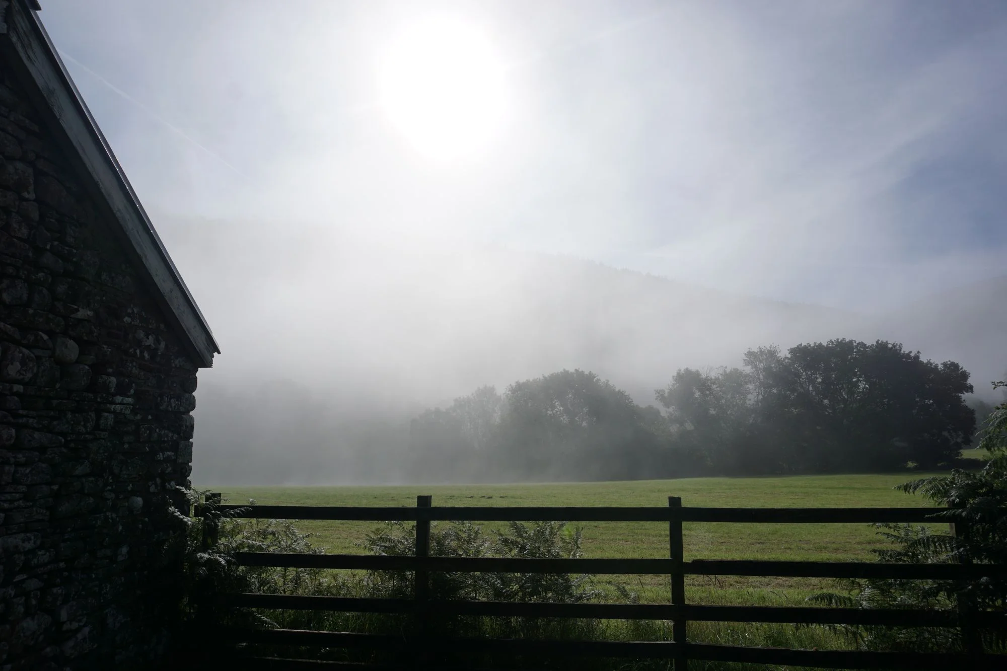
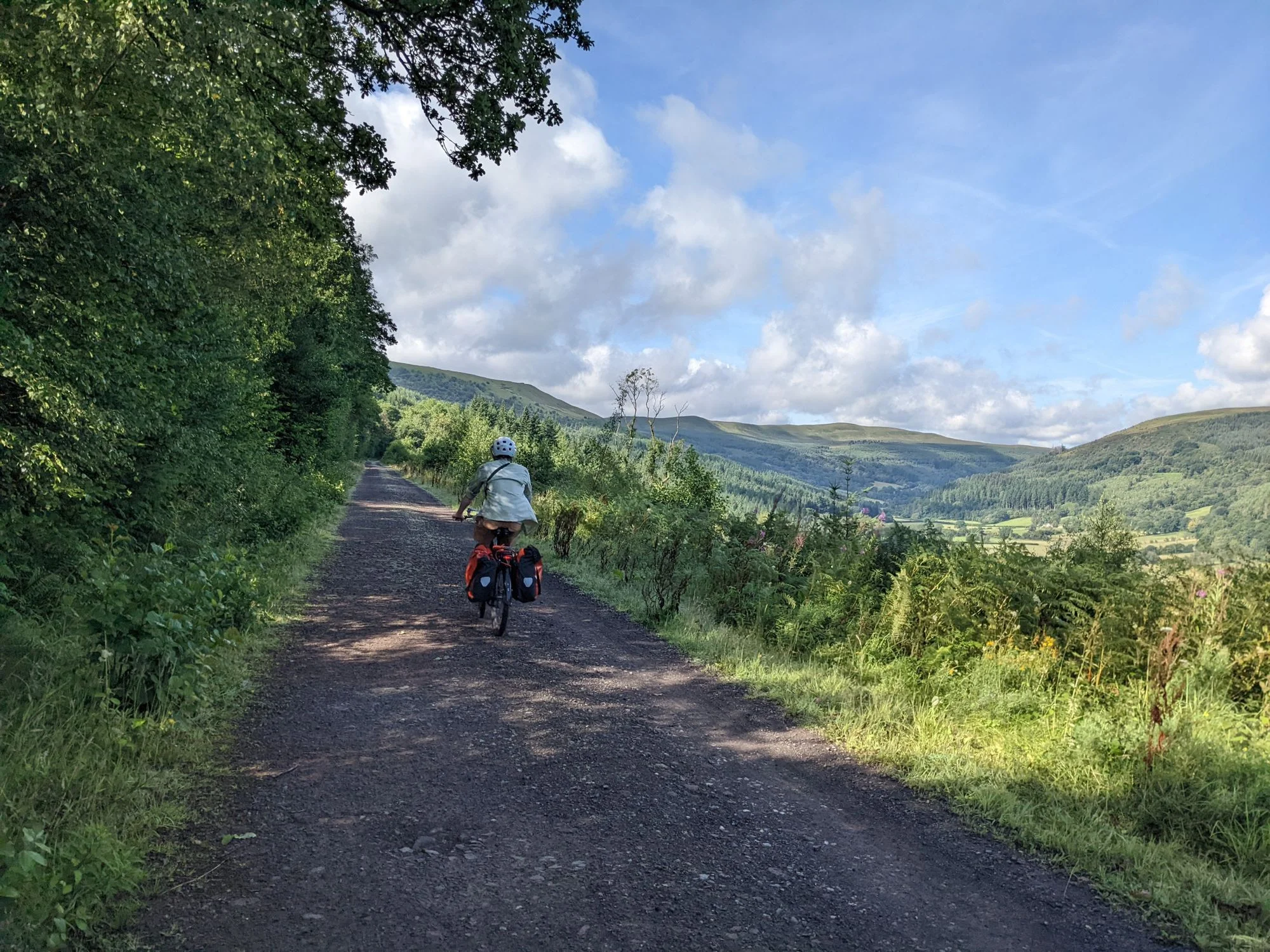
The next day, we woke up early -- I'm pretty sure our tent was fully packed up and we were riding out of the camping area before the sun had a chance to peek over the horizon. Our ride continued similarly to the previous afternoon's ride, and felt very easy after getting an adequate night's sleep. The hills were foggy, the hedges continued to need a good trimming, but the traffic was nonexistent and the skies above the fog were as blue as can be.
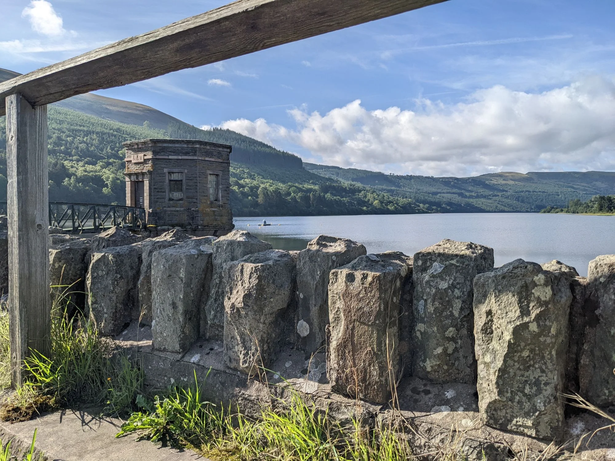
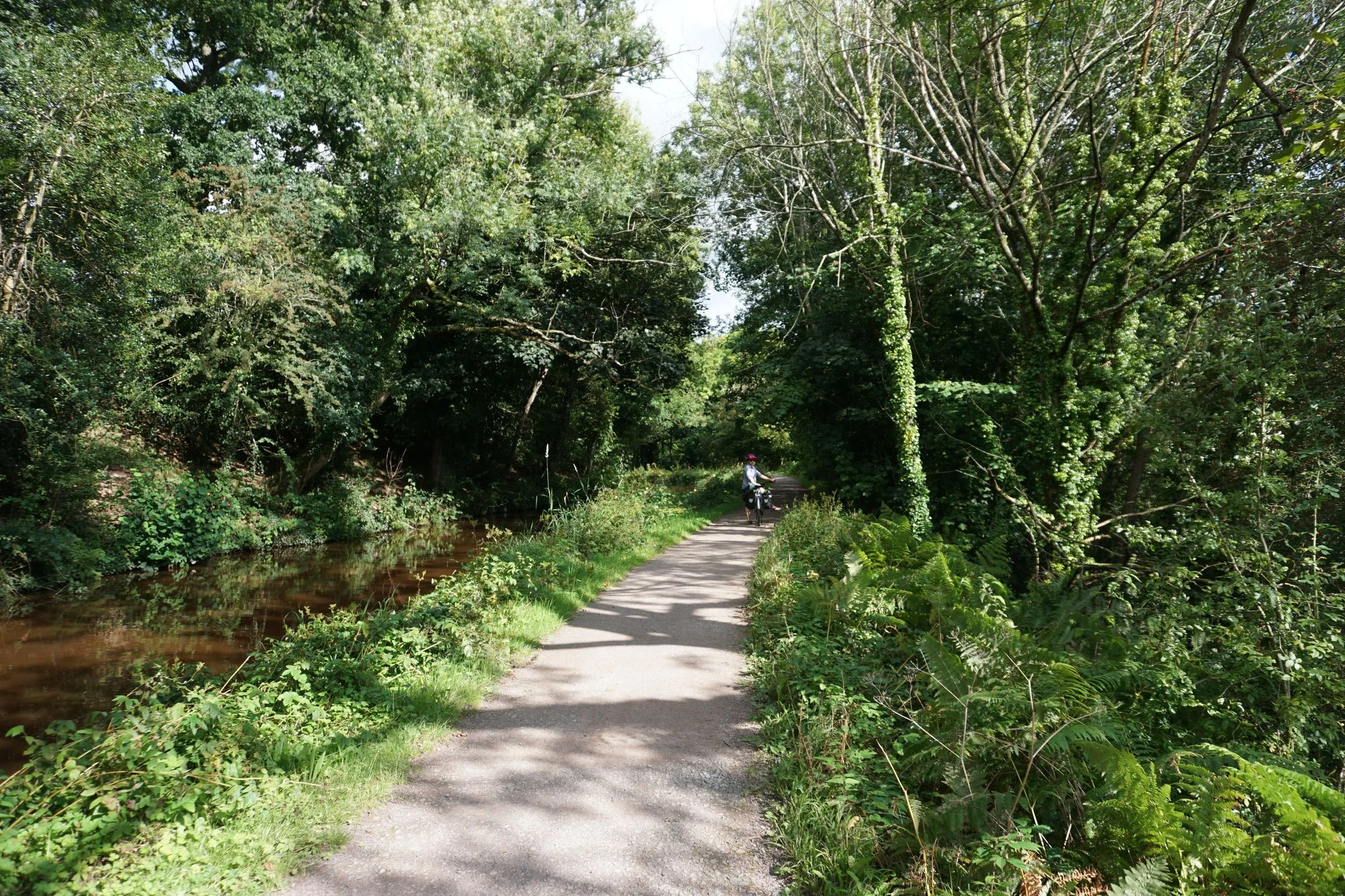
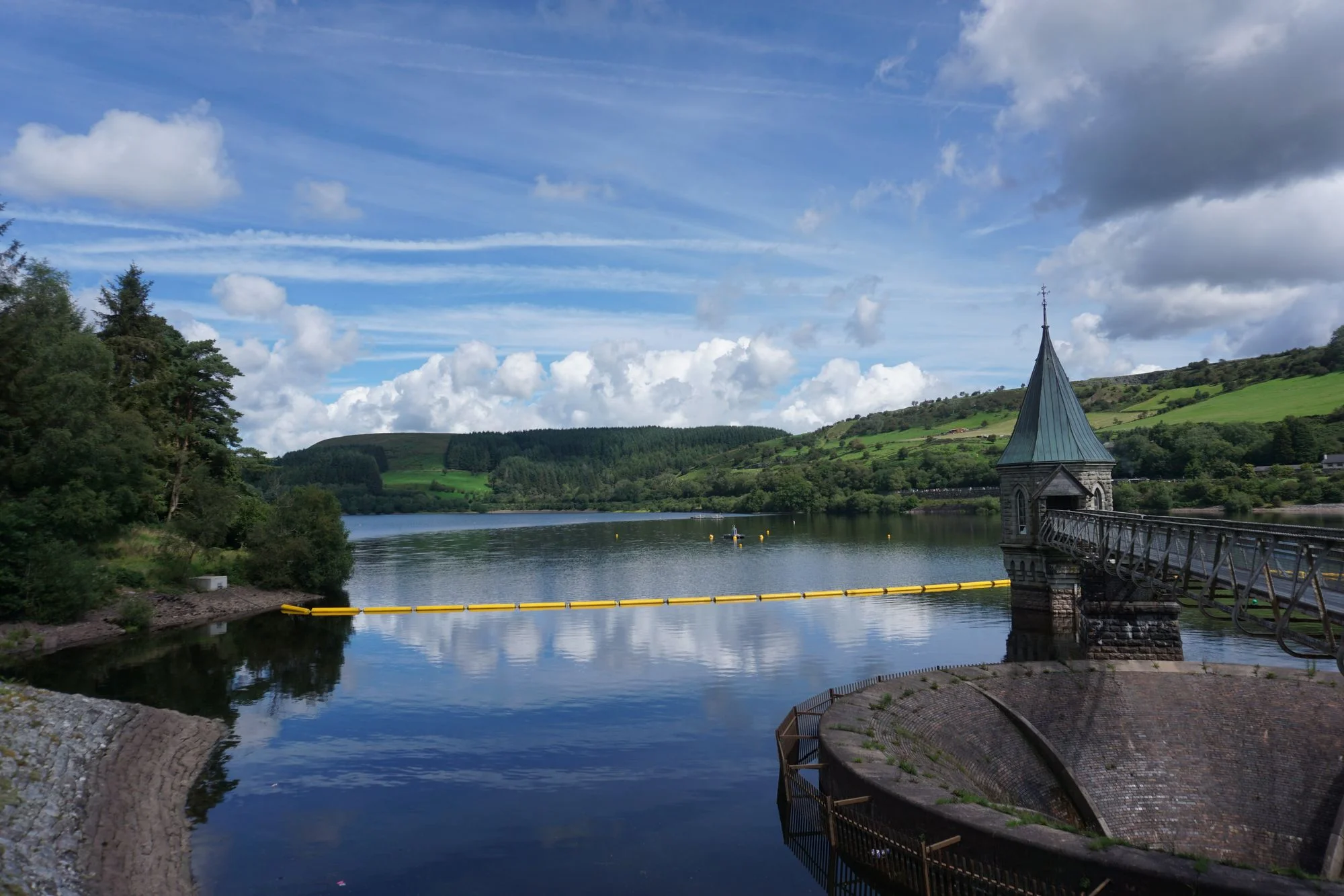
Before long, we wound up at a dam on a mountain lake with some very impressive views. We crossed the dam and found ourselves riding on a rail trail. Huzzah! For those who don't know, rail trails are the best way to cross a range of mountains by bike. The grade usually can't exceed 3%, which can be grueling if you're stuck riding that way for hours, but is much much easier than the 20% grades we typically see on unmaintained mountain roads designed for cars or horses.
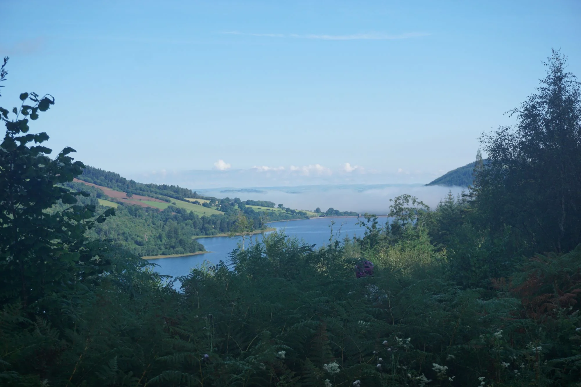
We pushed our way up the rail trail in record time, and before we knew it we were at the highest point of our day's ride. Hours ahead of our hoped schedule, well before noon. And we spotted a trailhead for a hike that we strongly suspected we could see the top of. With the strength of a good night's sleep and an unexpectedly easy climb coursing through our veins, we locked up the bikes and started our first UK hike.
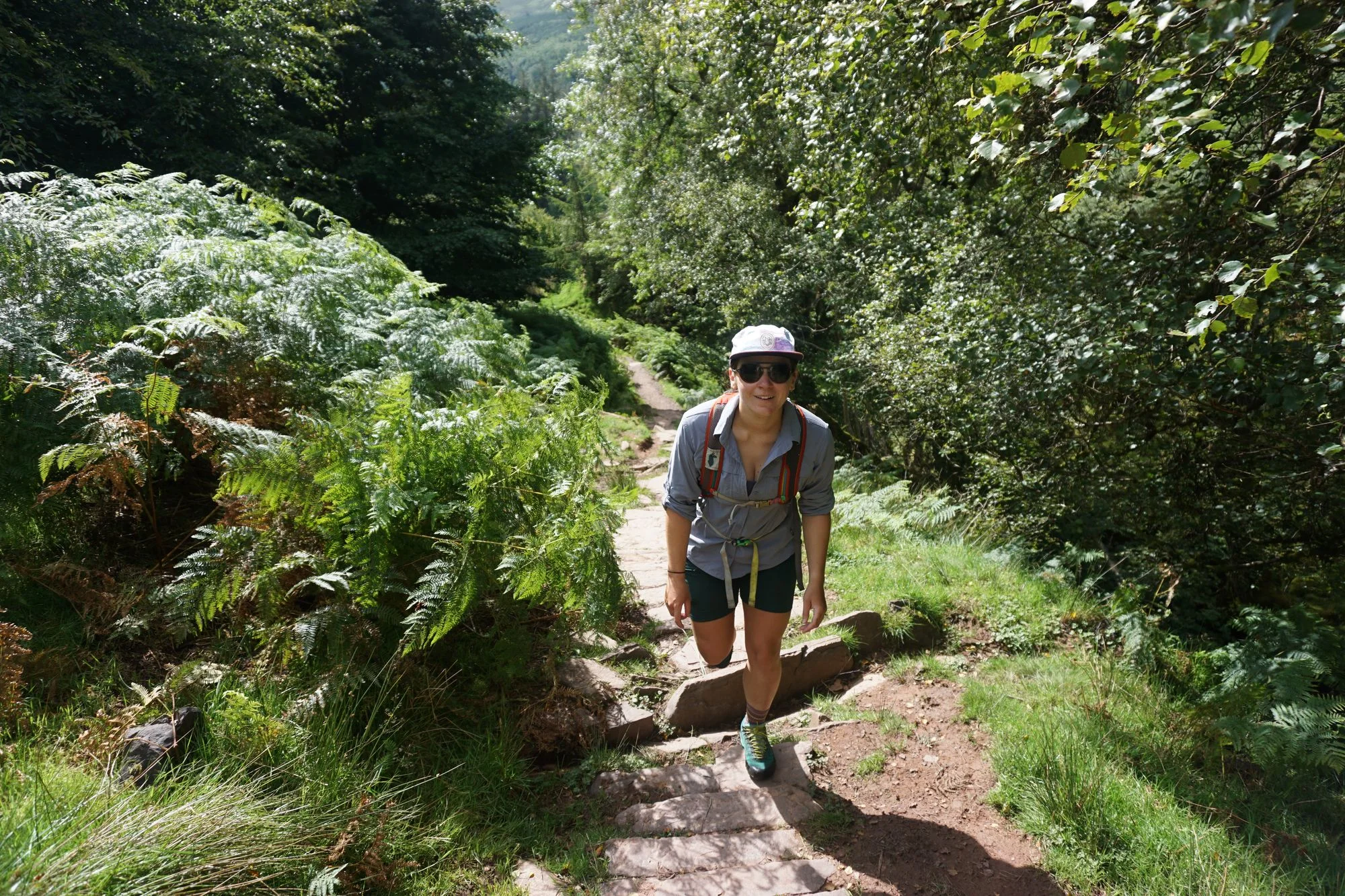
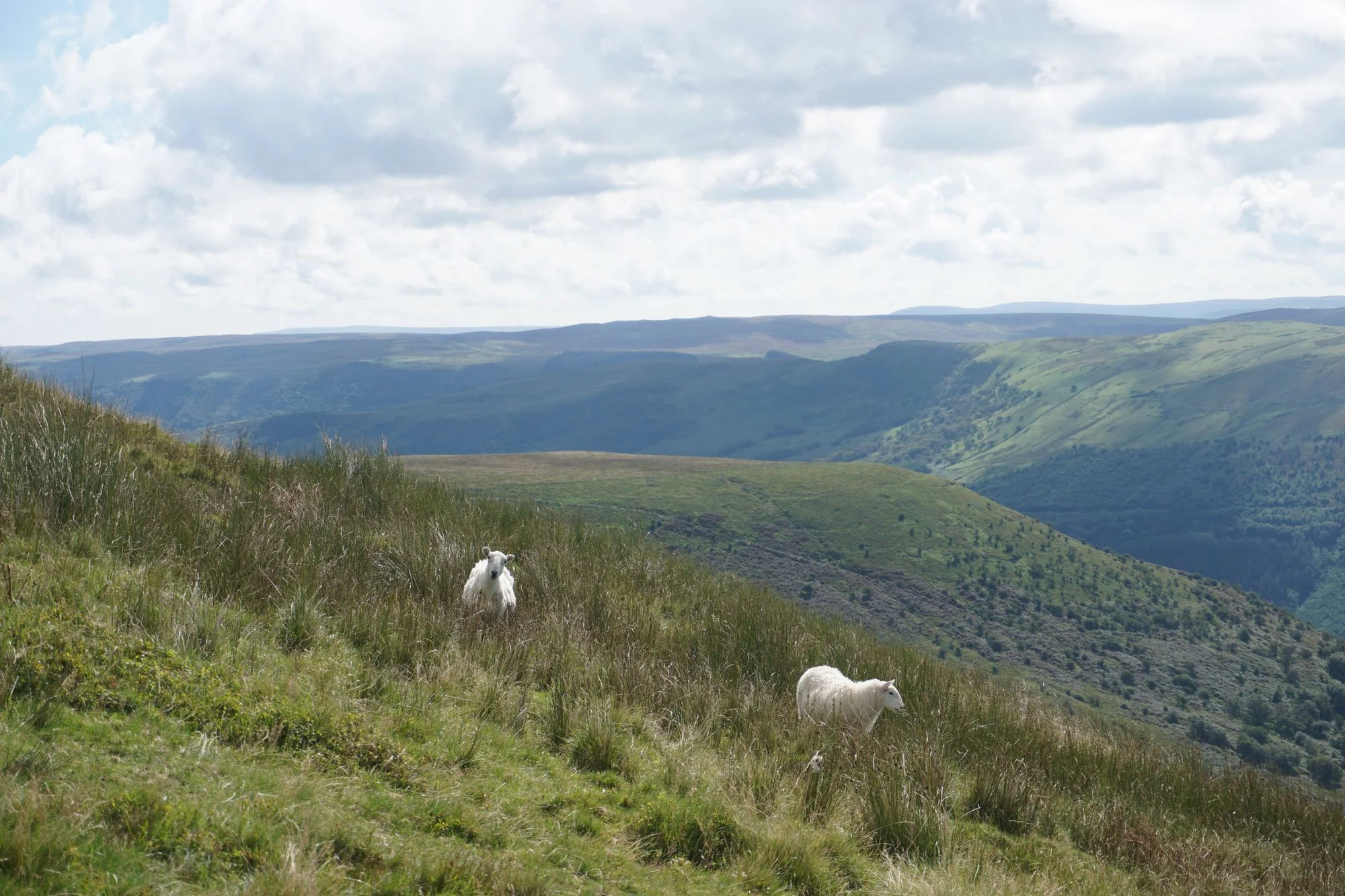
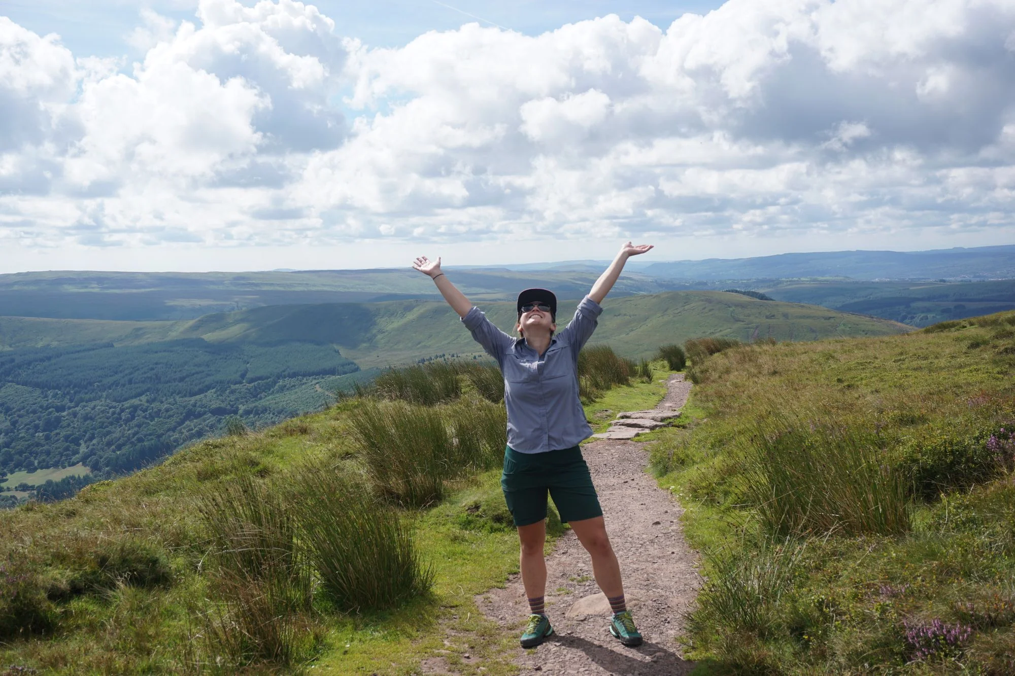
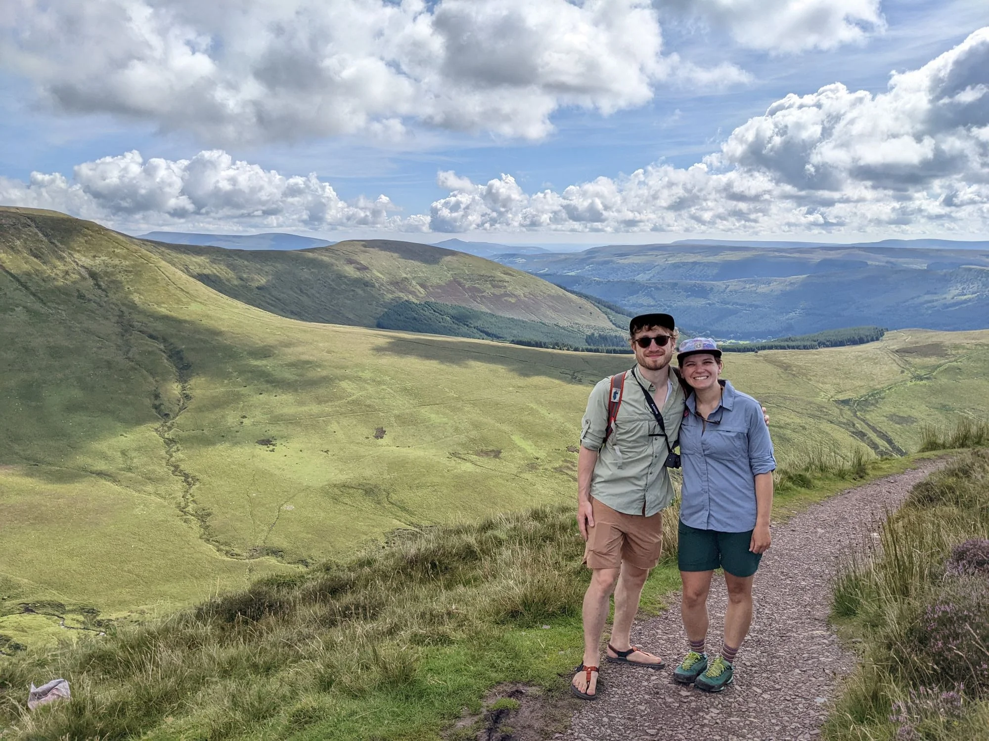
It turned out to be beautiful. But I'm fairly certain I'm one of very few people who has ever completed that hike wearing sandals. If only because a lot of sheep roam the Beacons, and they leave behind a lot of shit. When wearing sandals, you really have to watch your step. But it was very worth it for the views at the top of Bwlch y Ddwyallt.
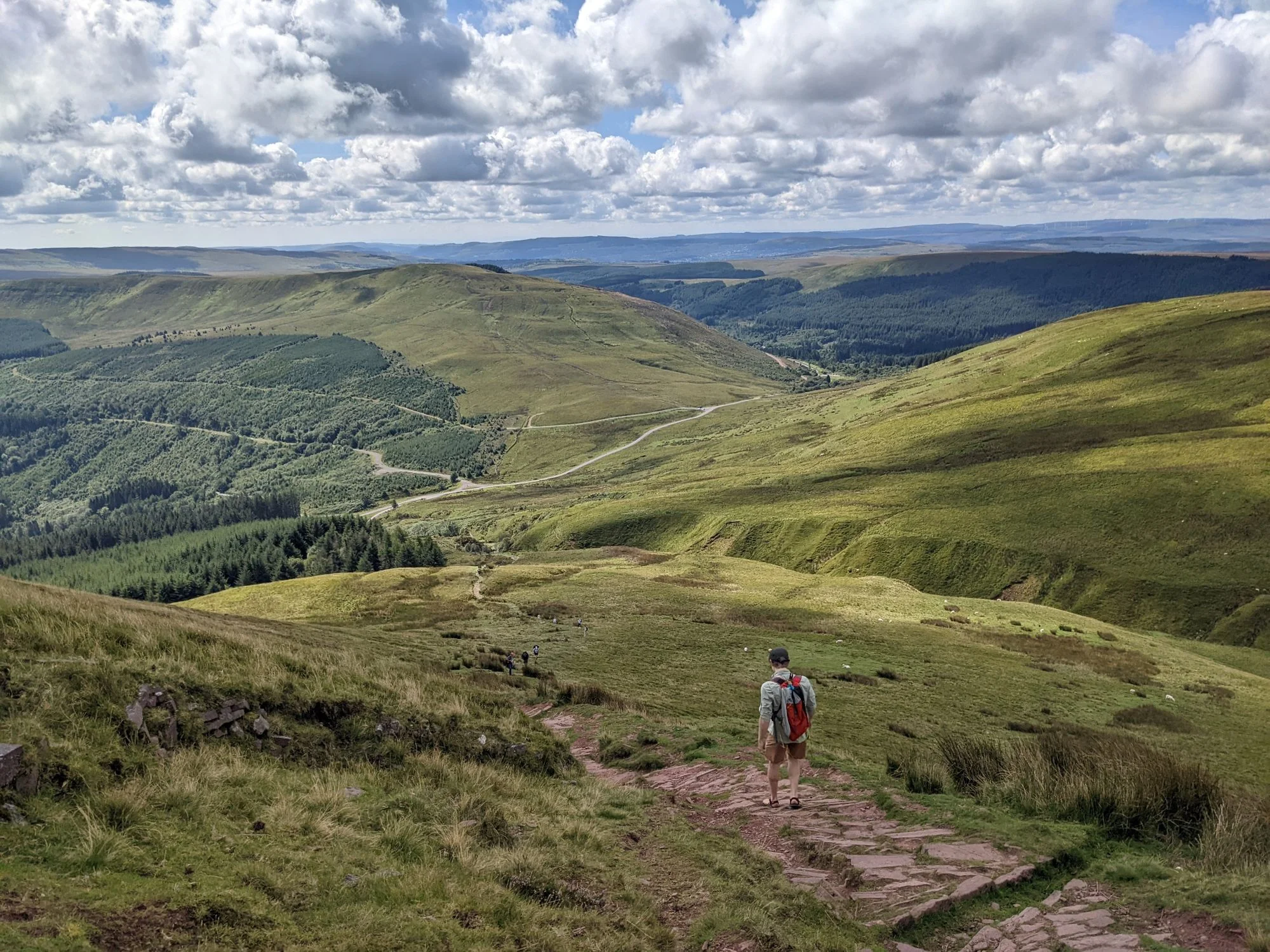
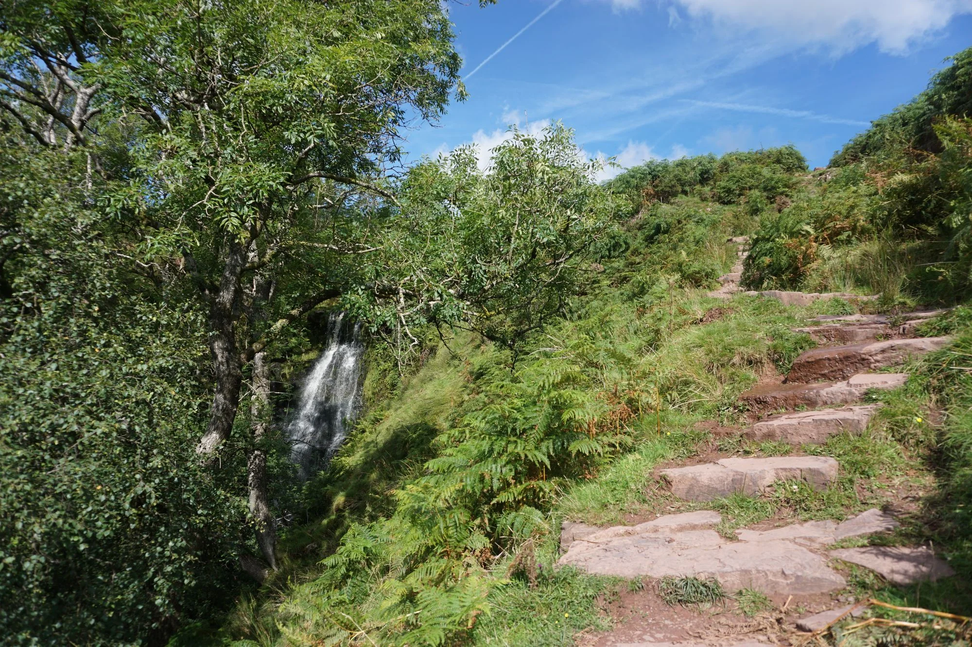
So we completed our surprise hike, saw some waterfalls, chatted with some folks near the top, took a picture, and then climbed back down. All in all, the surprise hike took up just one hour of our time.
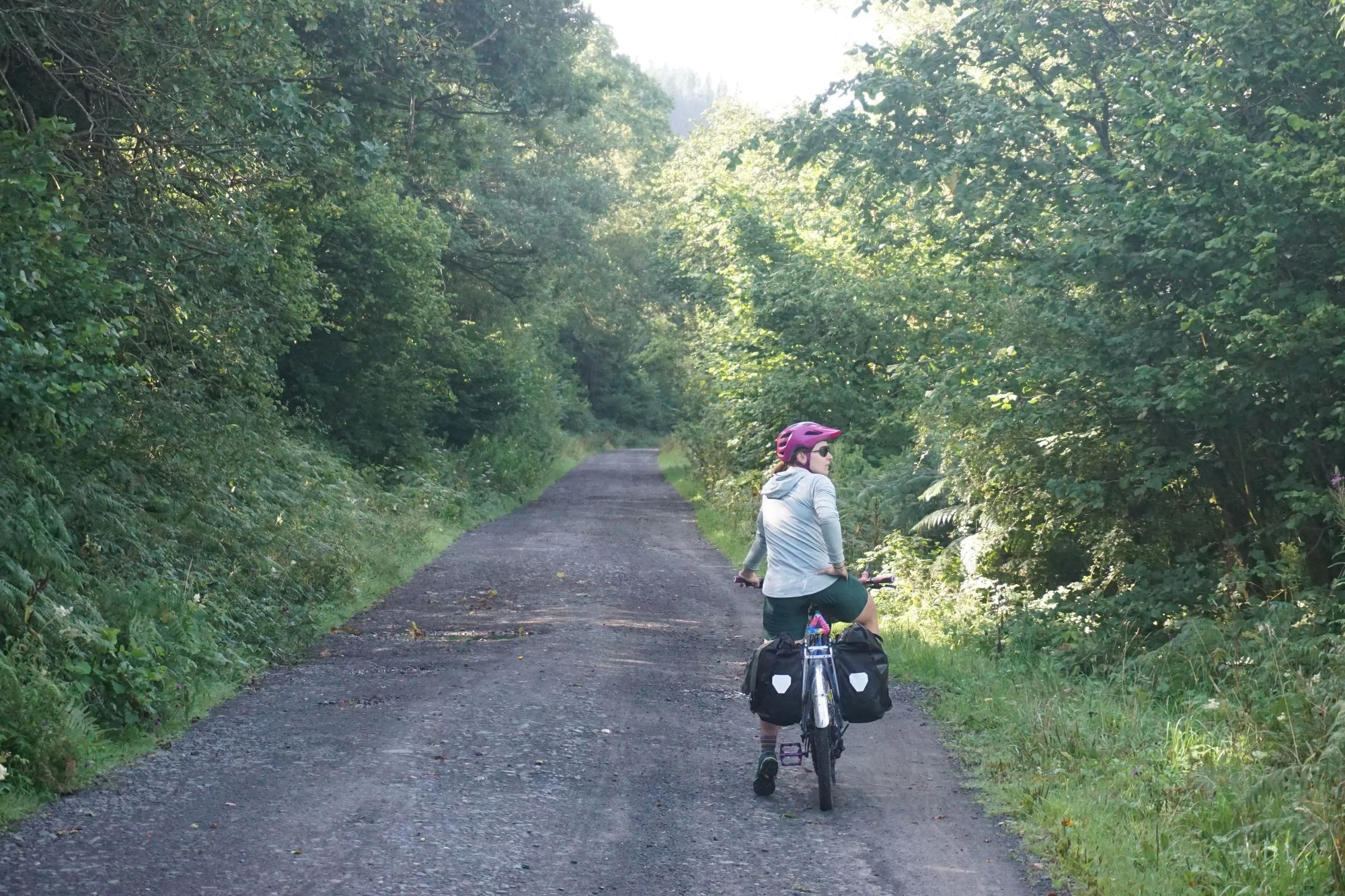
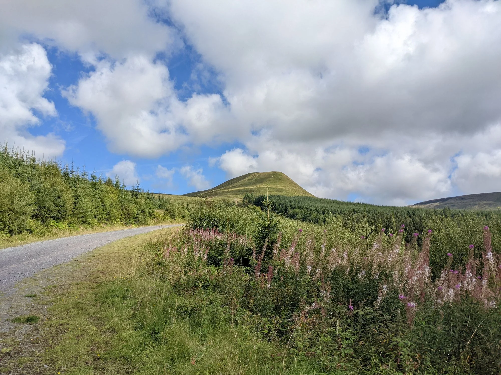
The trailhead was located on a paved road that seems to be the only way over the peak of the pass (seems like the railroad used to use a tunnel that has been abandoned for decades), but we only ended up riding on pavement for a mile or so before we found a windy gravel route that seemed to roughly parallel the paved downhill route. So of course we took a risk and rode the gravel trail. It turned out to be brilliant, with some really cool views of burns with tiny waterfalls and bright red rock formations.
We crossed another neat stone dam, then wound up on yet another rail trail. We sped downhill with hope in our hearts and plenty of energy for whatever challenges might pop up next.
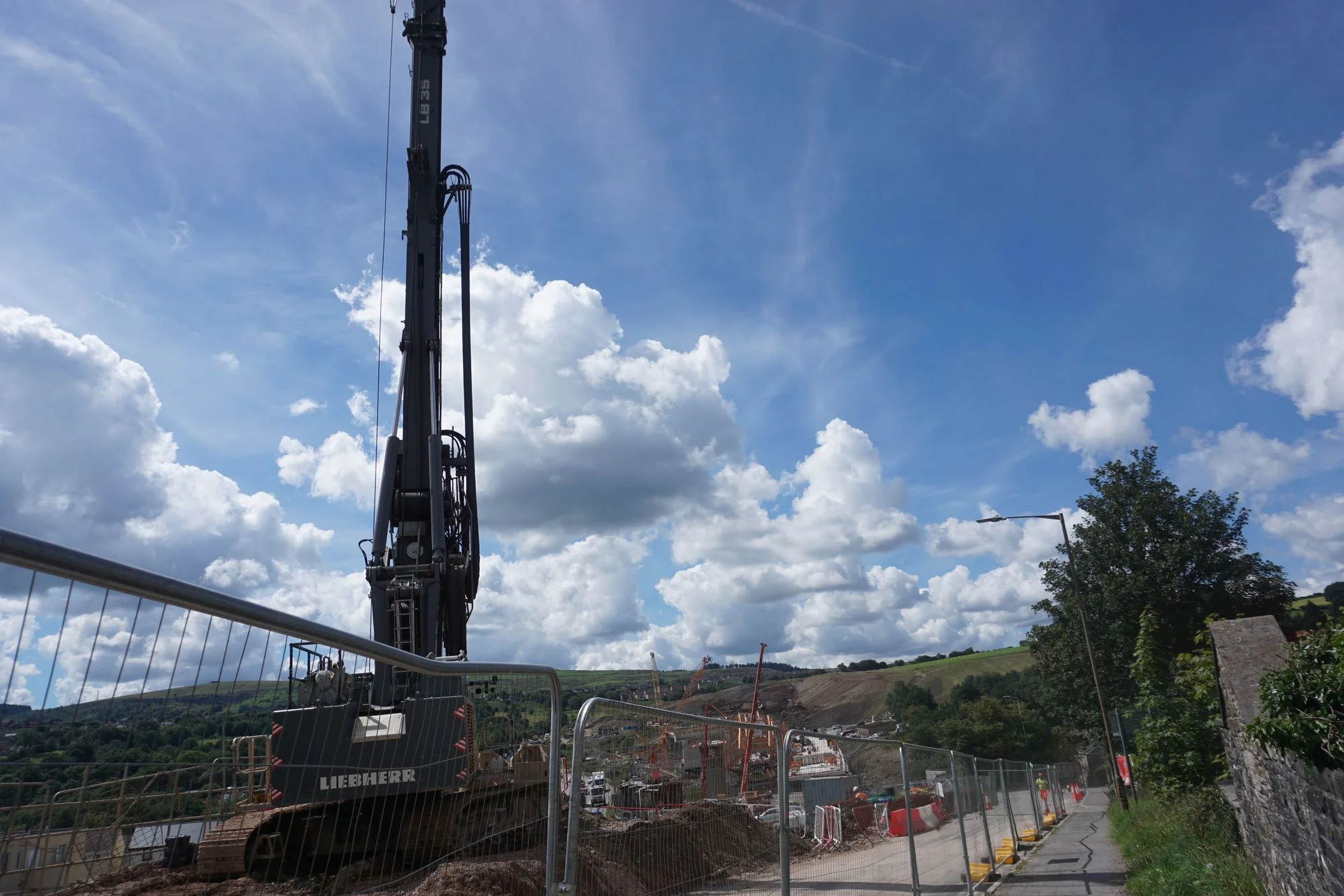
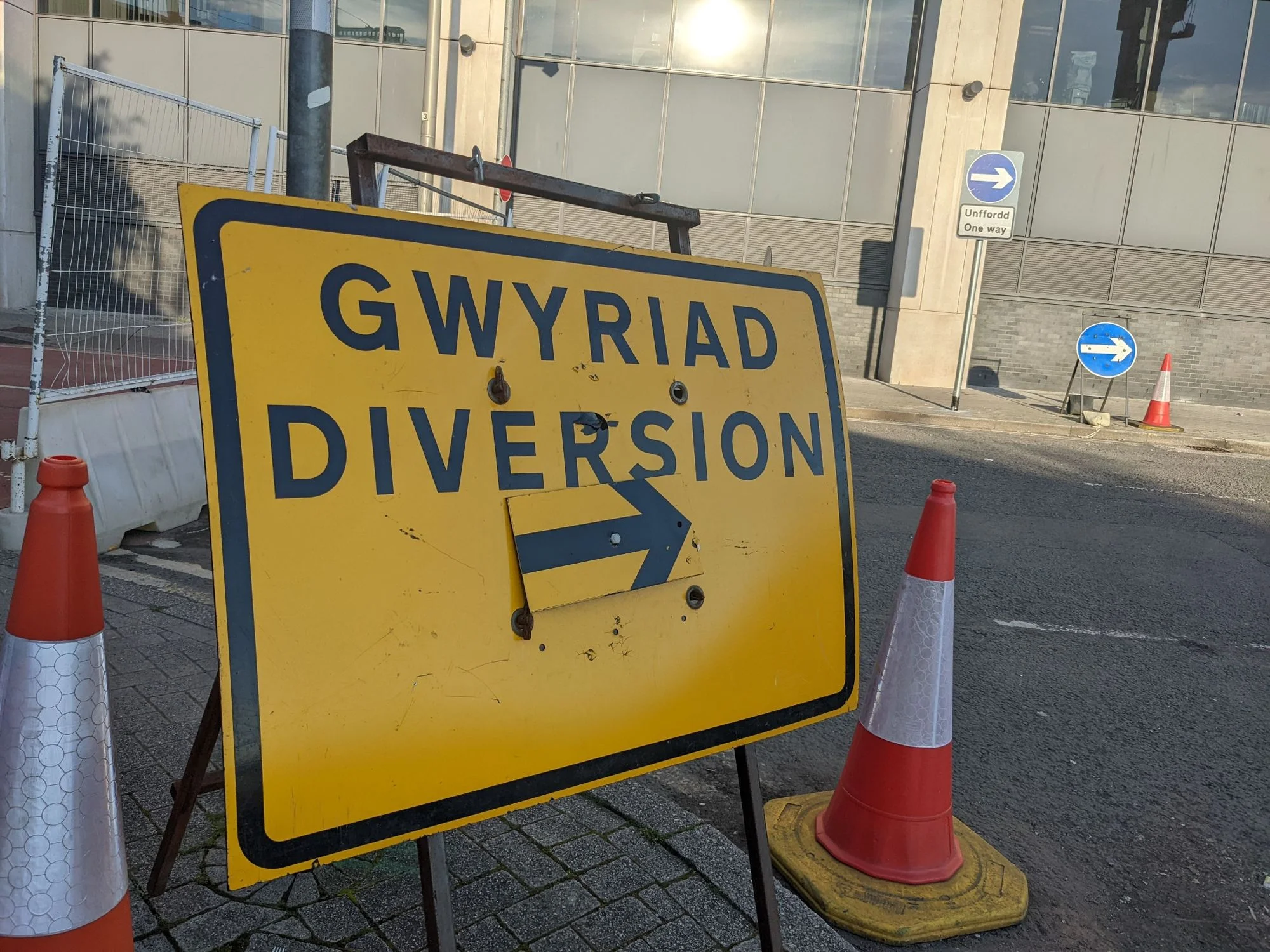
We were not entirely mentally prepared for what, for the number of times it appears on road signs in Wales, seems to be the unofficial state motto: gwyriad. AKA diversion. Or for you Americans out there, detour. For the rest of the ride to Cardiff, I'm pretty sure we rode nothing but diversions. There was some kind of massive bridge construction taking place in the next town, with a deeply convoluted path to a pedestrian bridge that only cost us 30 minutes of stress. Special thanks to the shirtless man drinking a beer in his front yard who provided surprisingly comprehensive and completely correct instructions to get to the rail trail from a section of town where the diversion just... ended. And what was the town called? Pant. It was really pants.

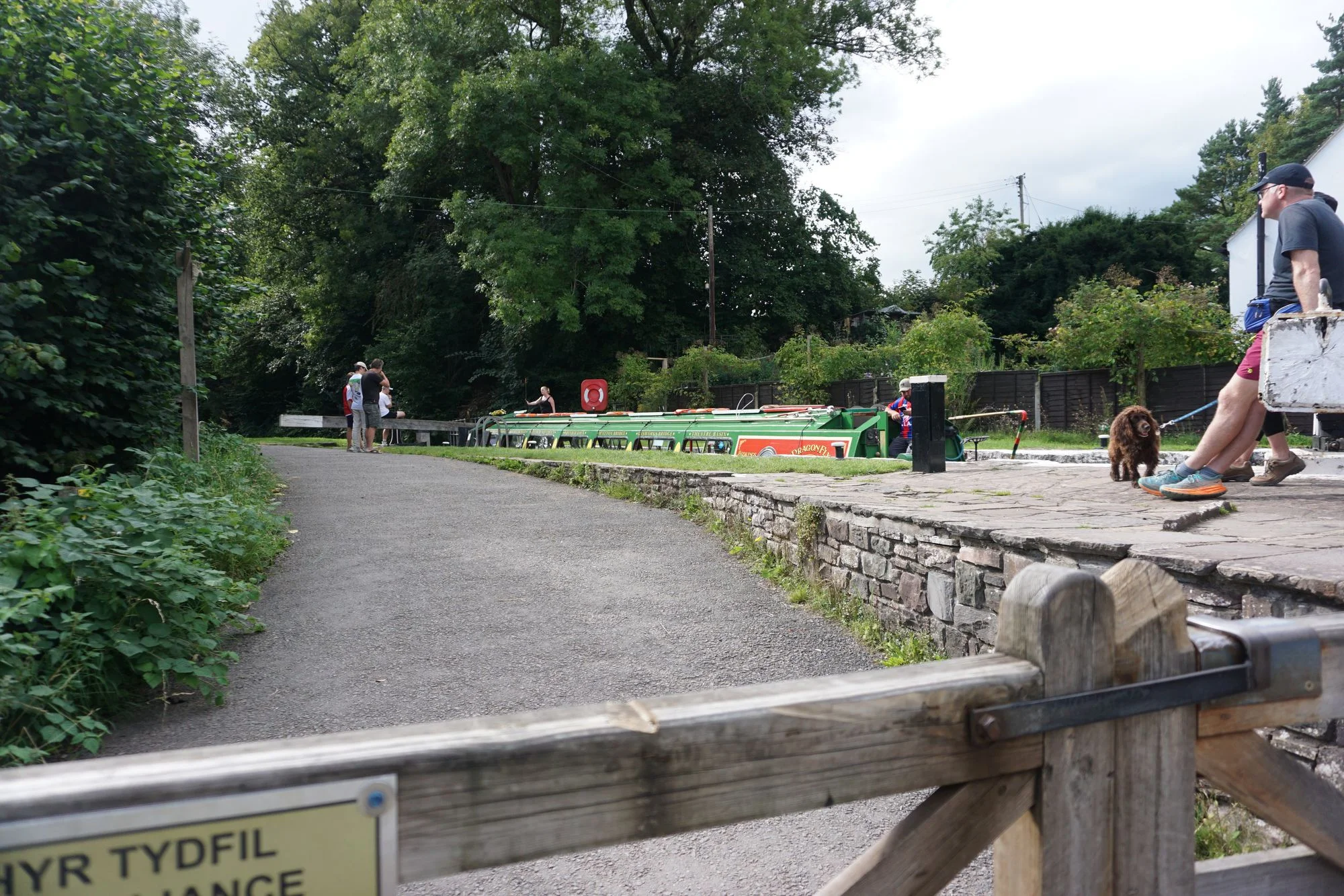
Slowly but surely, we made our way through a combination of diversions and functional rail trail bits all the way to Cardiff. My favorite section of the trail featured 25% grades, an unmarked intersection, and not one, but two heavily graffitied tunnels under a motorway that, naturally, only had steps. Fortunately, we were only aggressively passed by a couple of dirt bikes on the trail.
Once we made it to the outskirts of Cardiff, the city's infrastructure kicked in and bicycle travel was really easy. Just kidding; we got even more confused. Special points to the bike paths that go through the middle of a cloverleaf motorway interchange in Pantmawr; while I'm fairly certain it technically counts as bicycle infrastructure, because we were able to get through it, I also suspect it's the first infrastructure I've ever seen that qualifies as both malicious compliance and hostile architecture.
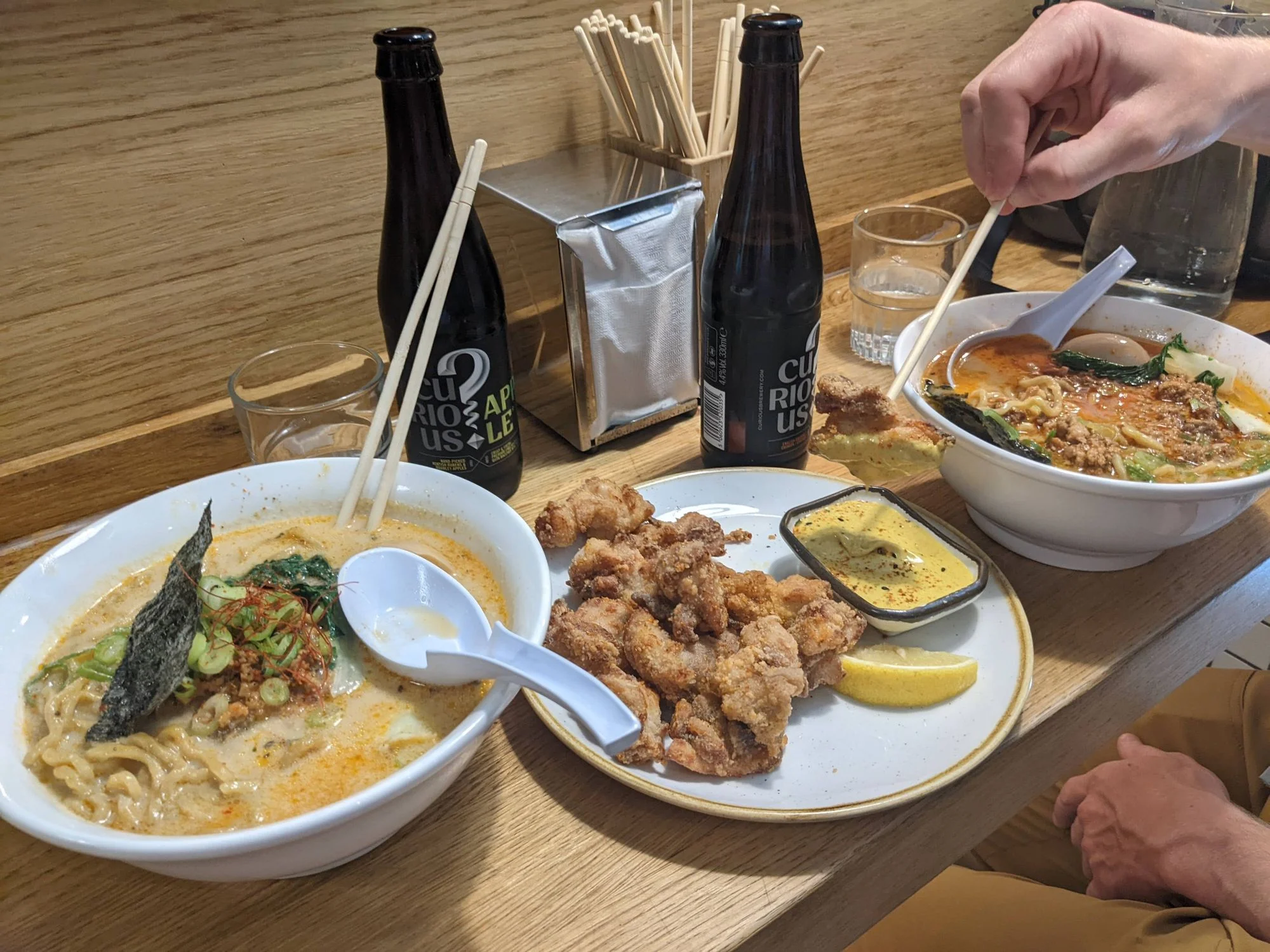
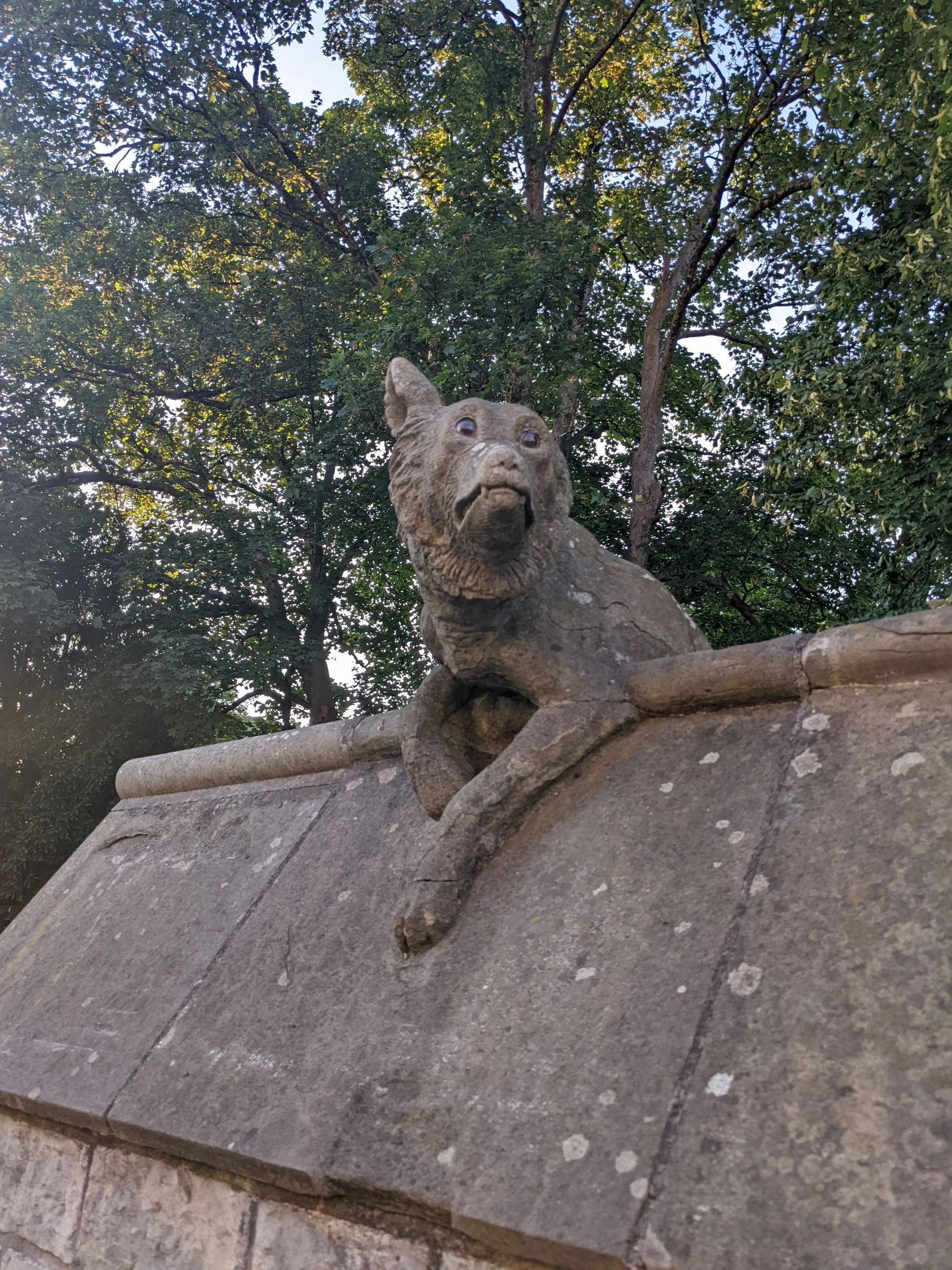
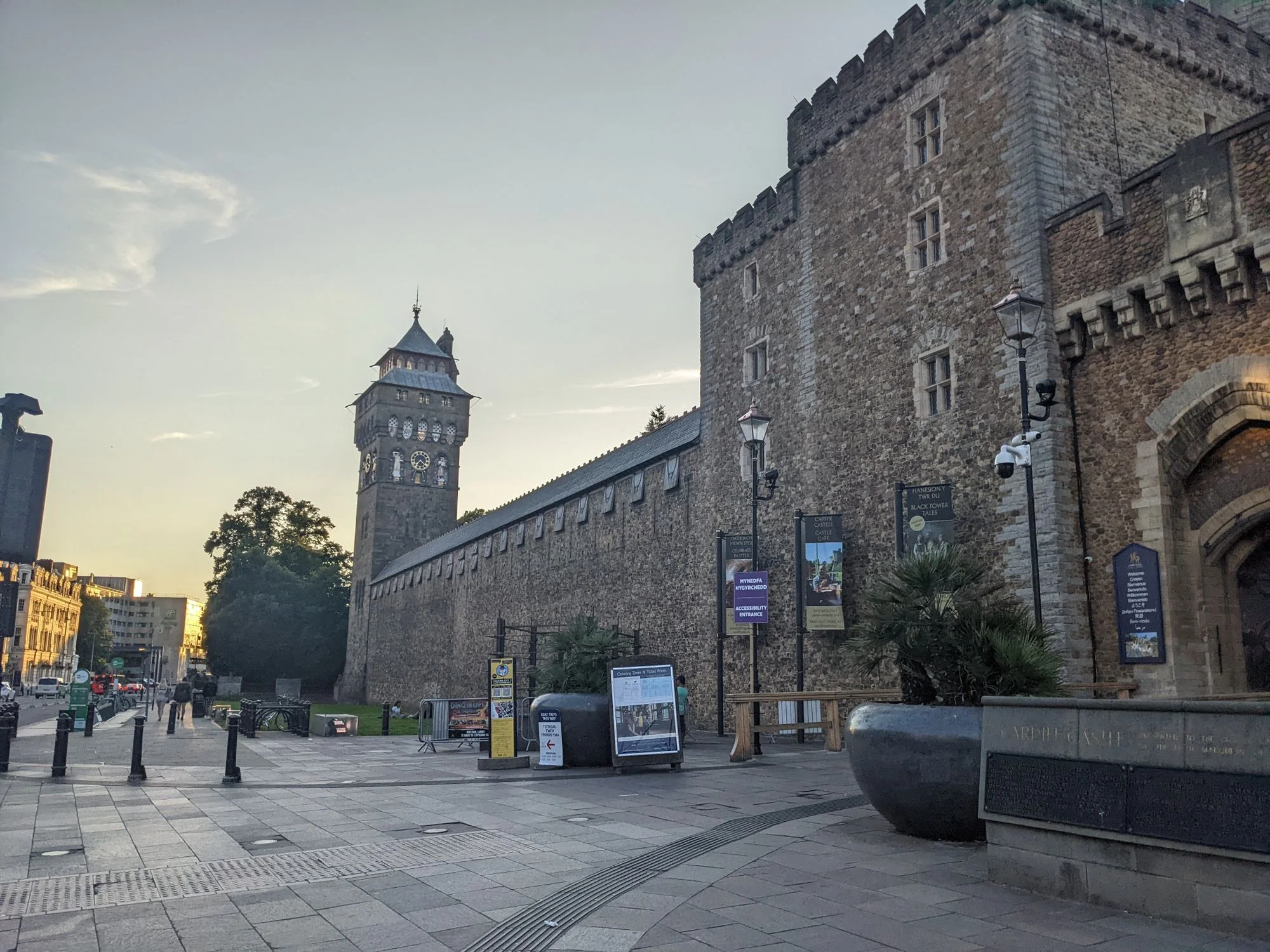
Anyway, we finally made our way into Cardiff a bit before sunset, and managed to find an absolutely amazing place for dinner: Matsudai Ramen. Absolutely perfect ramen and karage chicken. We bopped around town, checked out the castle, walked around in the park, got immediately very bored with the soulless mall-like downtown, and eventually ended the evening in a very cute wine bar called Nighthawks with some very cute art of the silly gargoyles on the nearby castle. But one afternoon in Cardiff was enough; we shortened our hotel stay to a single night, and decided to spend more time in Bristol, instead.
Our travel to Bristol started off strong, with a visit to Sparrow Coffee House. Unfortunately there wasn't a decent place to lock up our bikes, but the employees were very accomodating of our desire to sit right at the window, by the door, with eyes on our locked-together bicycles at all times. The coffee was excellent and the pastries were both fresh and well-made. A fine coffee shop.
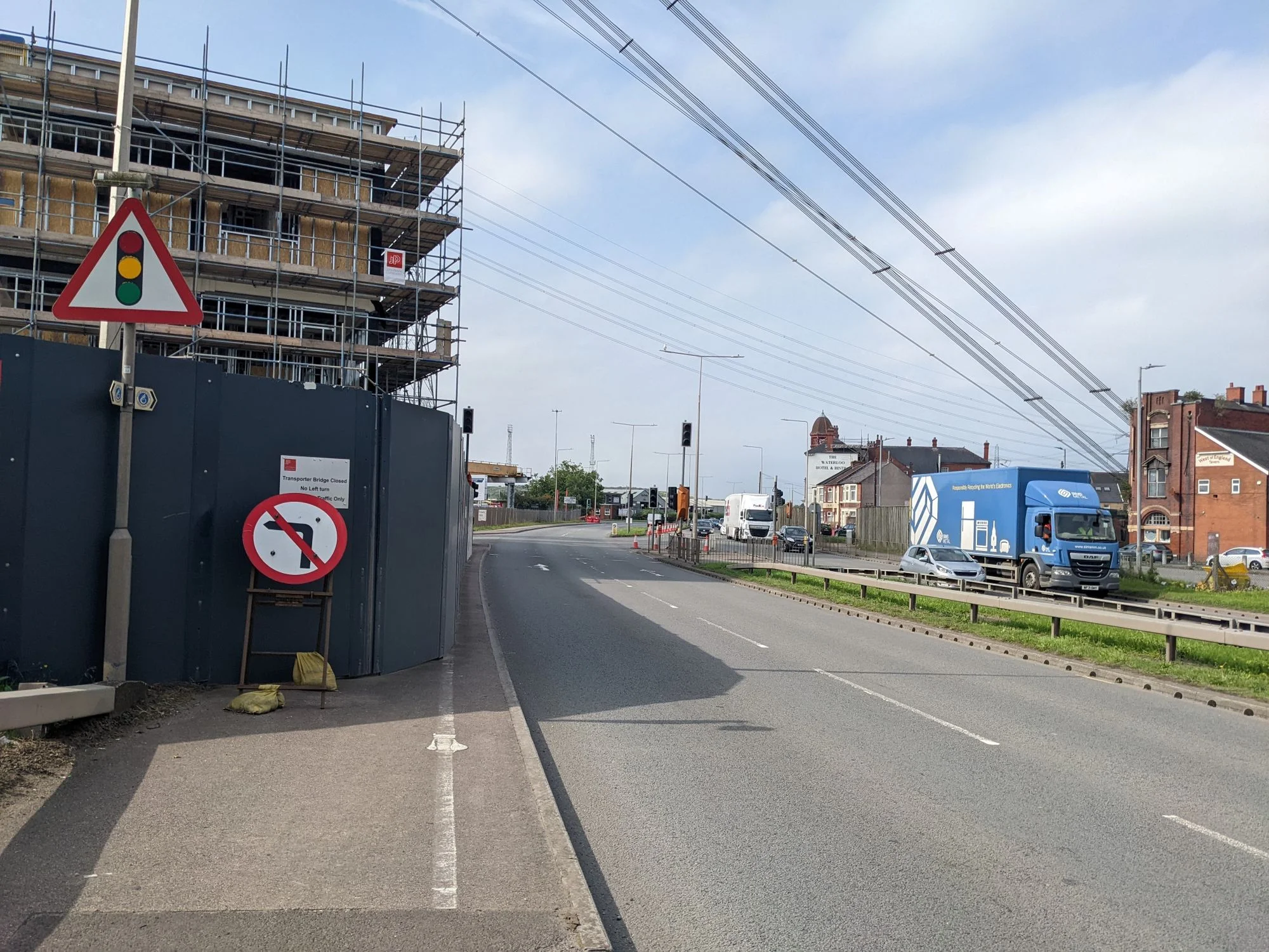
Unfortunately the "bike route" we followed out of Cardiff was a truly pathetic example of failed urban infrastructure. We fought our way over broken sidewalks, through gutter "bike lanes" full of trash, onto sharrows on the side of 4-lane highways, and past many, many fast food drive thrus full of hungry, distracted people with poor visibility. Eventually, the horrors petered out into sidewalkless business parks and we made it to the heavily irrigated flatlands surrounding Newport, which a placard informed us are actually extremely interesting and known as the Gwent Levels.
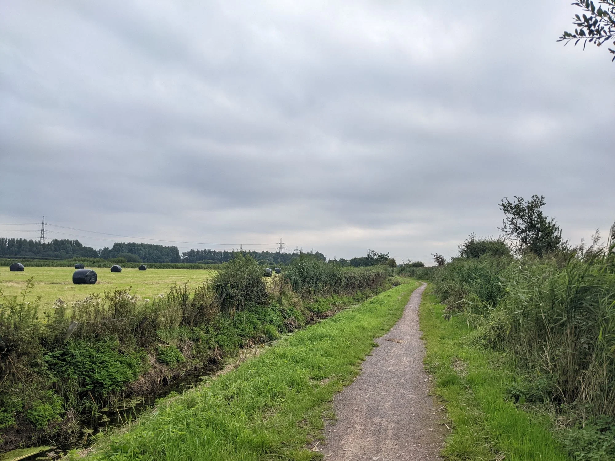
In the flatlands, the bike route got a little safer, but somehow less interesting. We passed through a few sad, publess towns, and past a lot of farmland and farmhouses that looked suspiciously similar to the poorly tended rural landscapes of Central NY. It's all very flat, very rural, and very full of ditches, which distribute water collected in 2000-year-old "reens" built by Roman military engineers. Much like Central NY, the placards and wikipedia entries are much more interesting than the experience.
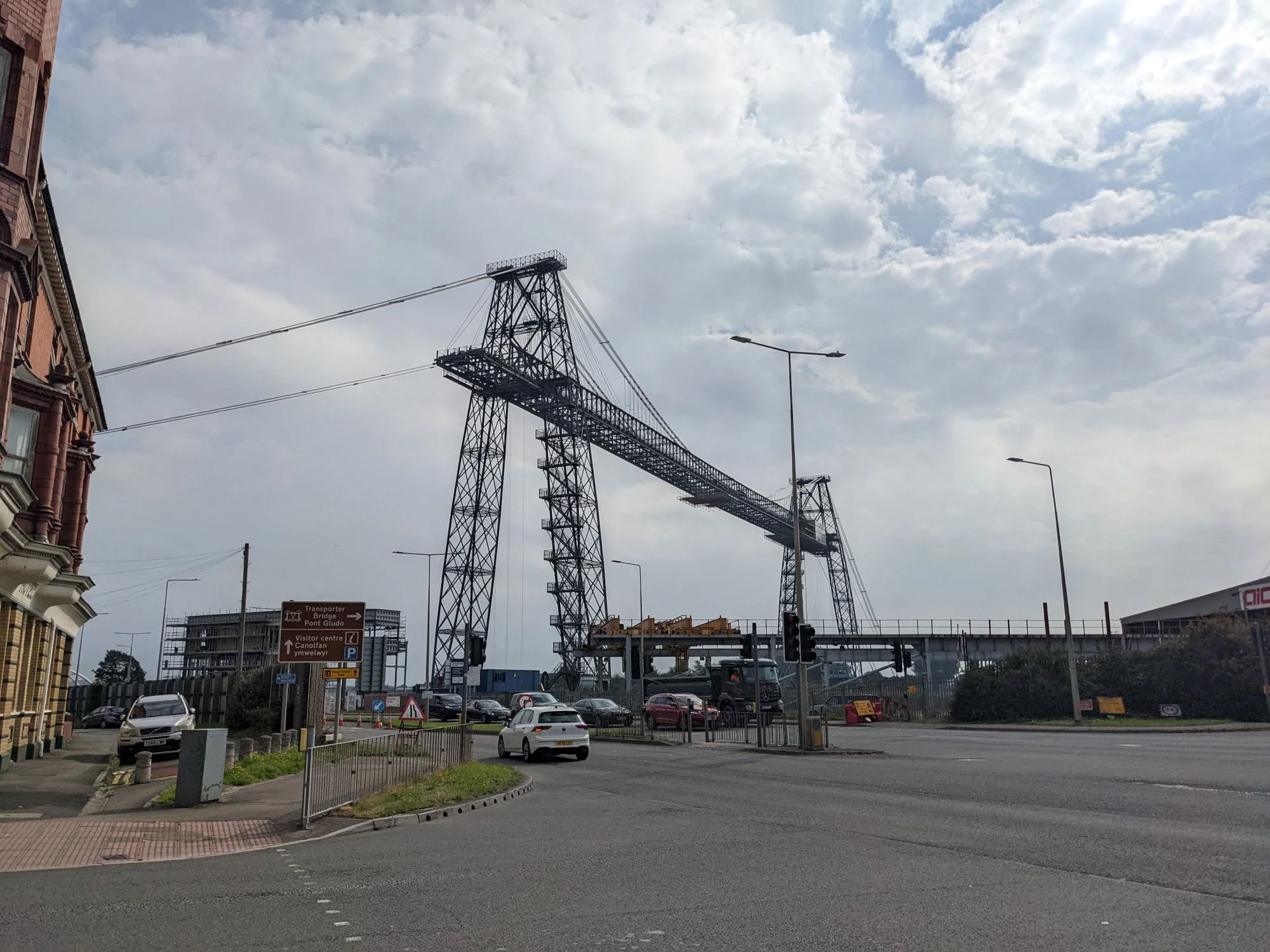
But we didn't stay in the flatlands forever. Between Cardiff and Bristol lies two distinct obstacles: the city of Newport and the very large estuary of the River Severn. The city of Newport turned out to be a brutal obstacle, forcing us to reroute against traffic on a nonexistent sidewalk along a very busy road to cross the River Usk over an alternate bridge because the bridge on the route is kind of crazy and we honestly couldn't tell if it was operational. Fortunately, the alternate bridge had an adequate bicycle lane and we managed to cross the river.
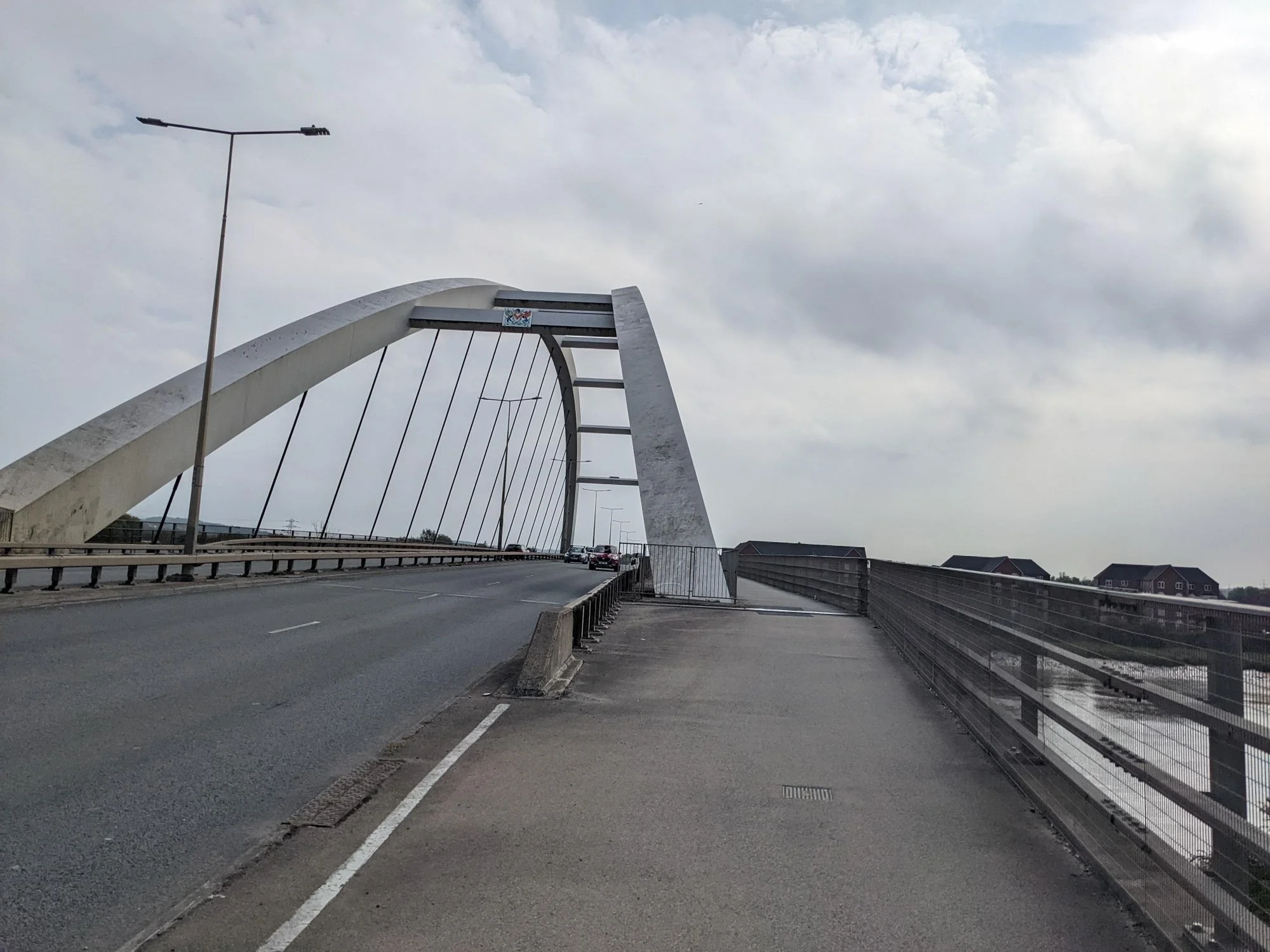
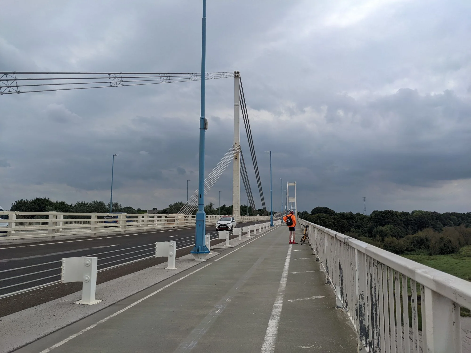
So we eventually made it through Newport, passed through more flatlands on the way to Caldicot, passed through even more flatlands on the way to Hardwick, and made mincemeat of the supposedly fiercer obstacle thanks to the help of the Wye and Severn Bridges. It was both the best and only 3 miles of bridge walkway bike riding I have ever done. The view was truly spectacular. And of course it was deeply pleasing to find a giant bridge that connects two countries that has a large and entirely adequate bicycle and pedestrian lane. The Queensboro Bridge in NYC should be ashamed of itself.
We entered England via the bridge and were immediately trapped in Aust. I'm not even kidding: the only way into and out of the town was motorway. The road (and the rest of bicycle route 4) south of town was completely closed for a construction project. So Meg and I stopped at a pub in Aust to figure things out. But only after we crossed 4 lanes of incredibly fast, incredibly loud, incredibly scary highway traffic a few times trying to figure out just how on earth to get out of the area.
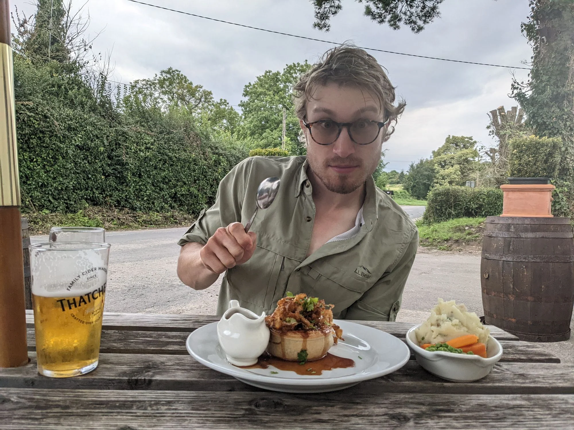
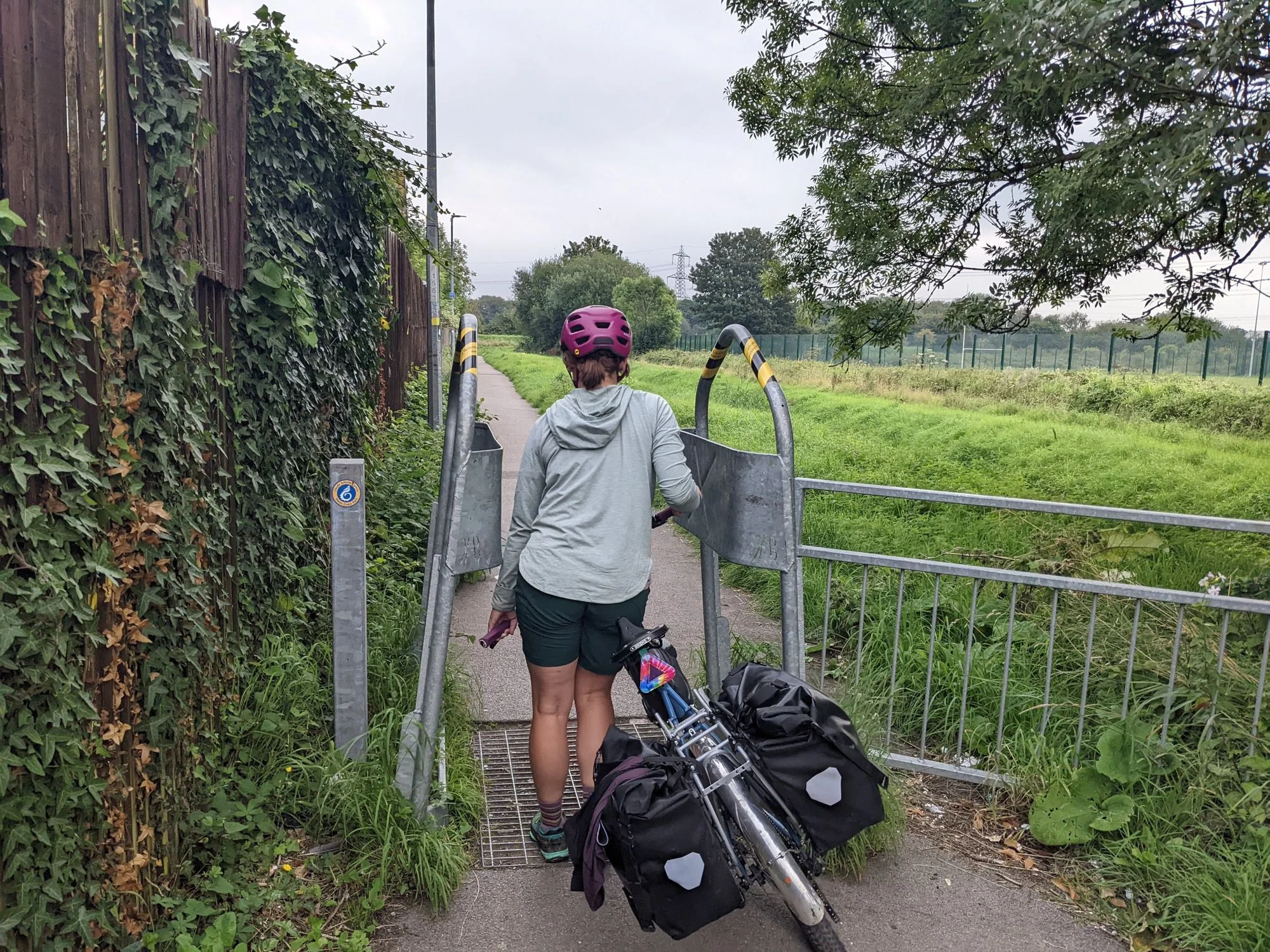
So we stopped for a pint and a pie, to figure things out. And we couldn't. We kept looking around on our maps, trying to find an alternate path. But nothing worked, and everything that did eventually led back to the same closed bicycle route and road. As far as I can tell, Aust is either purgatory or somehow linked to the Bermuda Triangle. We followed detour signs, and they seemed to just lead in a goddamned circle. We tried a tiny side road, but it ended in a locked gate by an entirely different motorway. We headed back into town, prepared to buy a house and settle down in Aust for good, because there was no way we were heading back to Wales. And that's when Meg saw it: an alternate pedestrian route using right-of-ways through fields. Clearly not exactly what we wanted, but we didn't have much choice. So we set out into the fields.
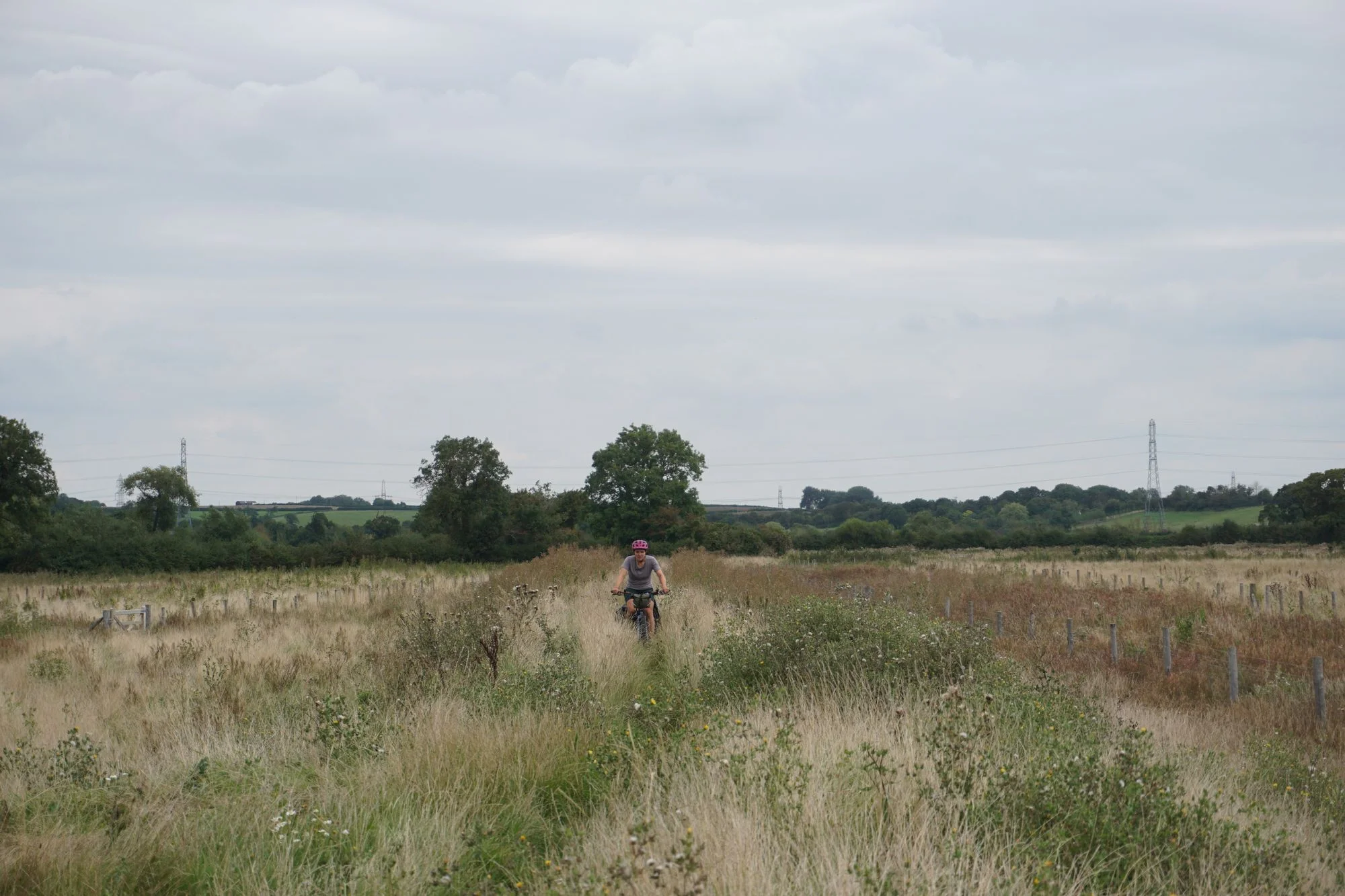
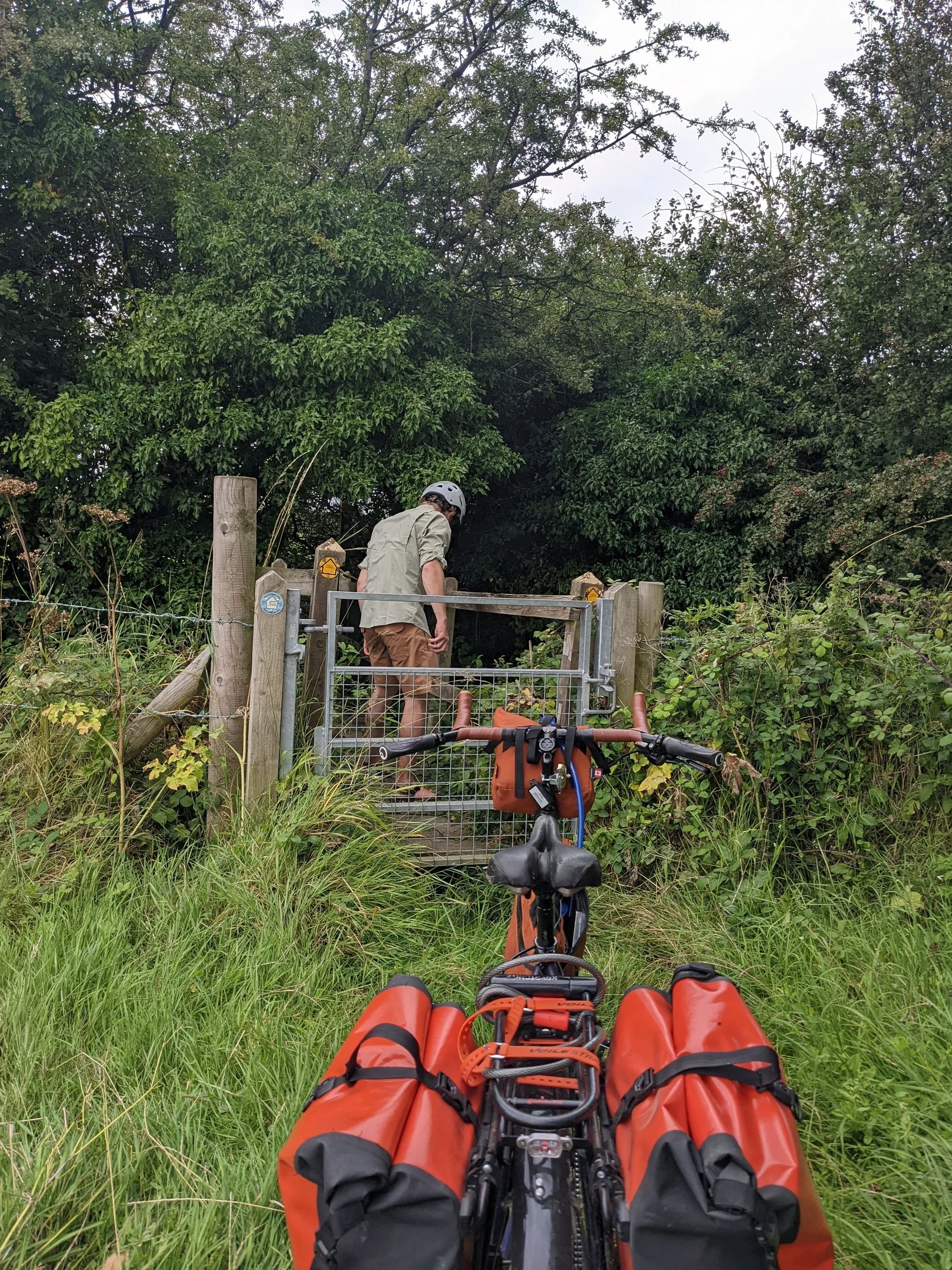
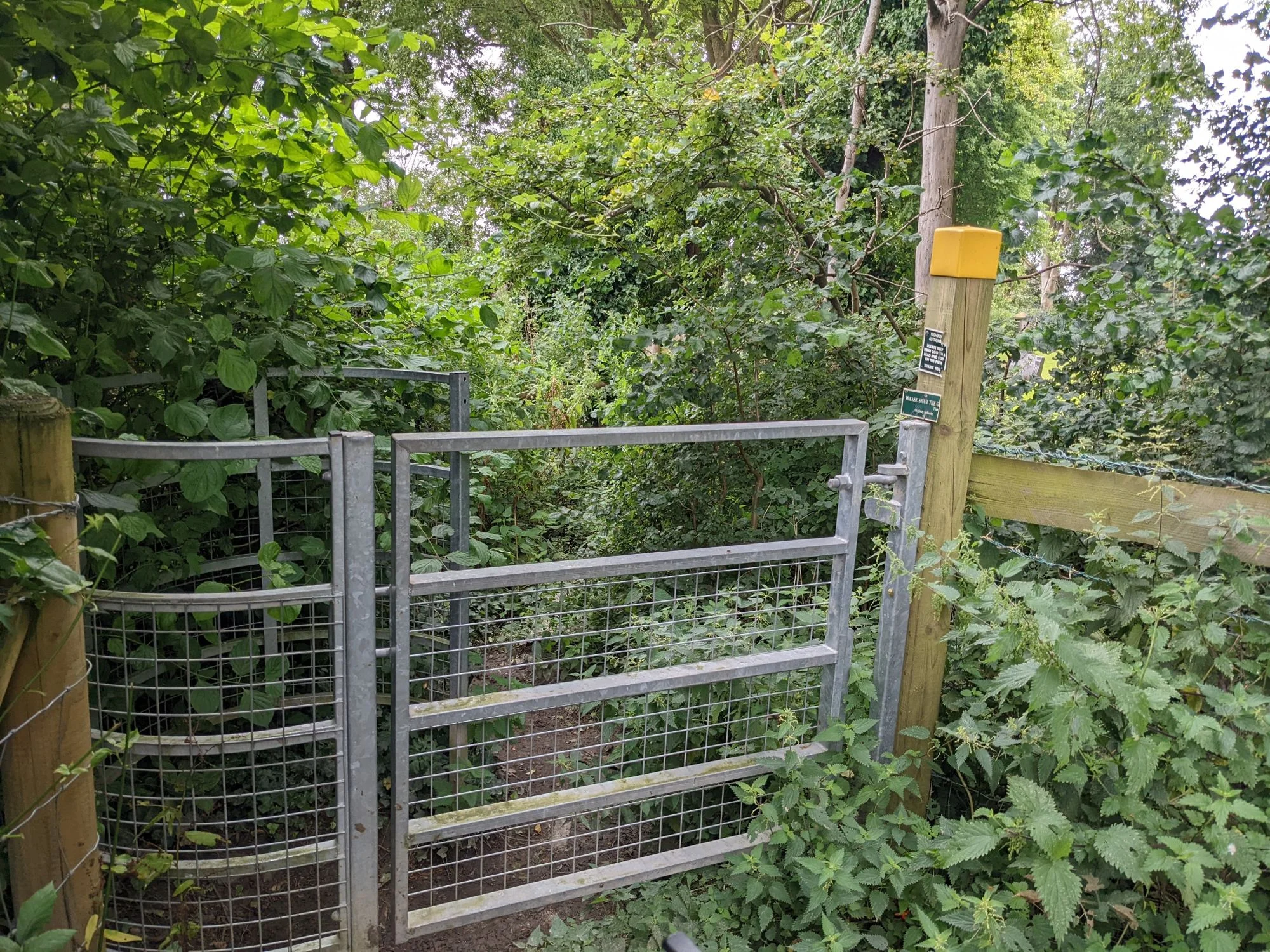
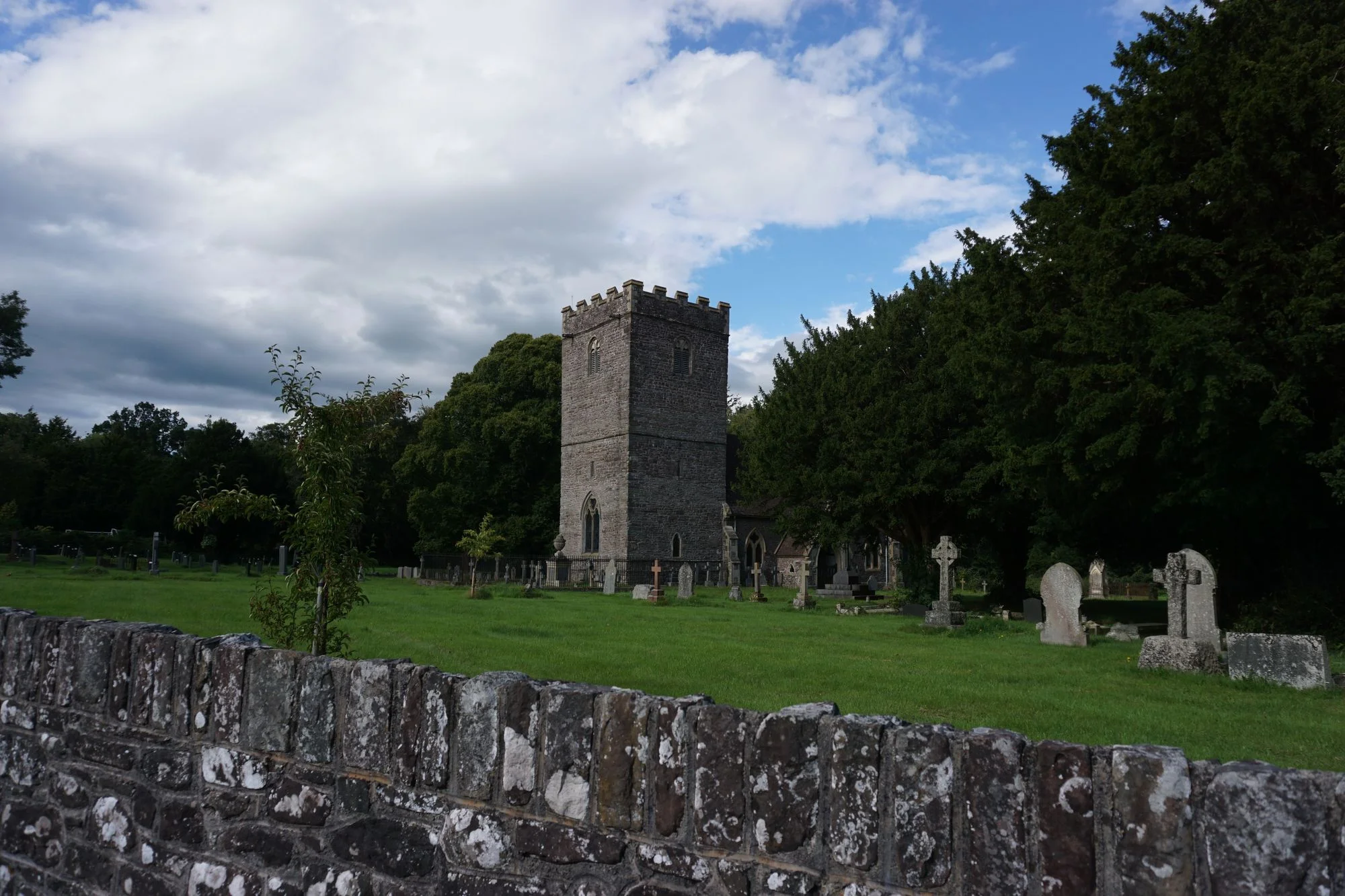
The pedestrian route started tame enough, with a pleasant walk on a canal path or sorts alongside a drainage ditch. Then, we managed to take a wrong turn, continuing down the canal path until it dead ended. And we realized that the actual route, indicated on the map back in the town center, walked us right through a ton of tall grass in a giant cow pie-strewn field, on a footpath that only arguably existed. So we did that. Through close to a dozen fields. Past the cow pies, into the tall grass, through the spiky weeds, over many a blackberry-thorn-surrounded-cattle gate (that were usually the circular kind, too small for the bikes, even without our bags, so I got a serious upper body workout). Sometimes there were bridges. We occasionally met some cows (thankfully no bulls). And then, after at least an hour of bushwhacking, we popped out a cattle gate right into a churchyard. Thankfully the churchyard gate was unlocked, so we ate a celebratory digestive and hopped back on the bikes for the final stretch to Bristol.
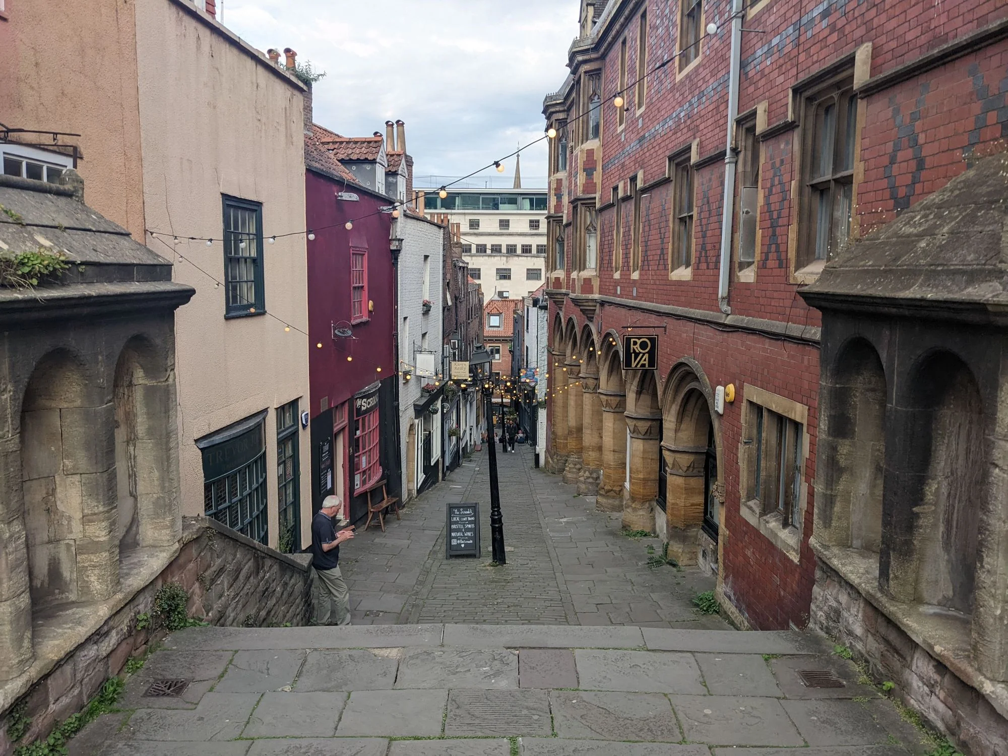
The rest of the ride to Bristol was quite nice. We found ourselves on a mixture of brand new cycleways, very quiet backroads, and several cycleways that used to be roads but were now entirely closed to car traffic. We passed a motorway and what looked like an Amazon warehouse, hopped on a bike lane on a somewhat busy (but slow moving) urban road, and wham, we found ourselves in Durdham and Clifton Downs, suddenly in the walkable core of Bristol. Since the Downs are at the top of one of the largest hills in the city, we enjoyed a speedy and scenic downhill ride into the city centre and stumbled upon the brand new and very impressive Bahn Wagon eatery for a quick bite. Once we took a second to adjust to being in a city (instead of surrounded by cows in a field with no people in sight), we dropped the bikes off at a hotel and started exploring the city.
Thanks for reading! Tune in next time to find out our favorite parts of Bristol, our ride to Bath, and the thrilling conclusion to our journey in London.
When I get around to posting it, you can find Part 7 here.