Leadville, Twin Lakes, and Turquoise Lake Loop
June 04, 2021
This weekend's bike trip in Lake County was a little different from our past bike trips. I learned:
-
some valuable lessons about charging your bike lights
-
that Mandarb (my 1990s steel mountain bike) can handle just about any terrain I can throw at him
-
that a 13% grade is just about the steepest hill I can climb on rocky, muddy terrain
-
even if Colorado is usually sunny... that thunderstorms can still take several hours to blow over
Even so, I had an absolute blast. It felt good to complete my most difficult bike ride ever (with both natural and personal-stupidity imposed obstacles) and come out safe and sound on the other side. After this weekend, I'm finally starting to feel ready for camping with just the bicycles. And we've even figured out a solid strategy for beating Denver's famous weekend mountain traffic.
The Legend of the Ghost Starbucks
It all started Friday morning, sometime around 6 AM. Meg and I got up, had a quick smoothie and an aeropress, and headed up into the mountains. By 7:30, we reached our intended destination: a Starbucks at Copper Mountain. We picked it as a pleasant looking option for working remotely all day, where we could keep our laptops charged, sit at a patio space, subtly position beautiful mountain views behind us during video chats with coworkers, and not feel too bad about taking up a seat all day.
At least, that was the plan.
But it turns out that despite a very convincing Google Maps listing for that Starbucks, the location itself is now closed. Sometime in the last 4 weeks, based on the last review and images on the listing, that Starbucks disappeared off the face of the planet. There wasn't even a sign left behind!
Anyway, there went our plan to hang out all day at the closest Starbucks to Leadville and work remotely so we could nab a campsite in the early afternoon. Instead, we drove up to new record holder of "closest Starbucks to Leadville," currently found in Frisco. My review as follows:
-
they didn't have any bacon gouda breakfast sandwiches left, 0/10 stars
-
ample outdoor space (glass garage doors, at a chain coffee shop?)
-
OK amount of outlets
-
super friendly employees (no offense, University of Rochester campus Starbucks)
-
great views of the mountains to intimidate my coworkers in video chats
All in all, it served us well for a morning's remote work.
In the afternoon, we spent our lunch hour travelling down to Leadville to nab some lunch and inch closer to our intended campsite. We ended up eating at the Silver Llama, a touristy yet competent cafe. A burrito and some chicken later, we headed down to our final destination: Twin Lakes.
Double the Lakes, Double the Fun
Twin Lakes has no shortage of beautiful campsites, but seeing as we live in Colorado and everyone constantly wants to hike and camp, we were a little nervous that we'd show up and all the campsites would be occupied, or even worse, that we'd end up at a campsite with no view of the lakes and mountains.
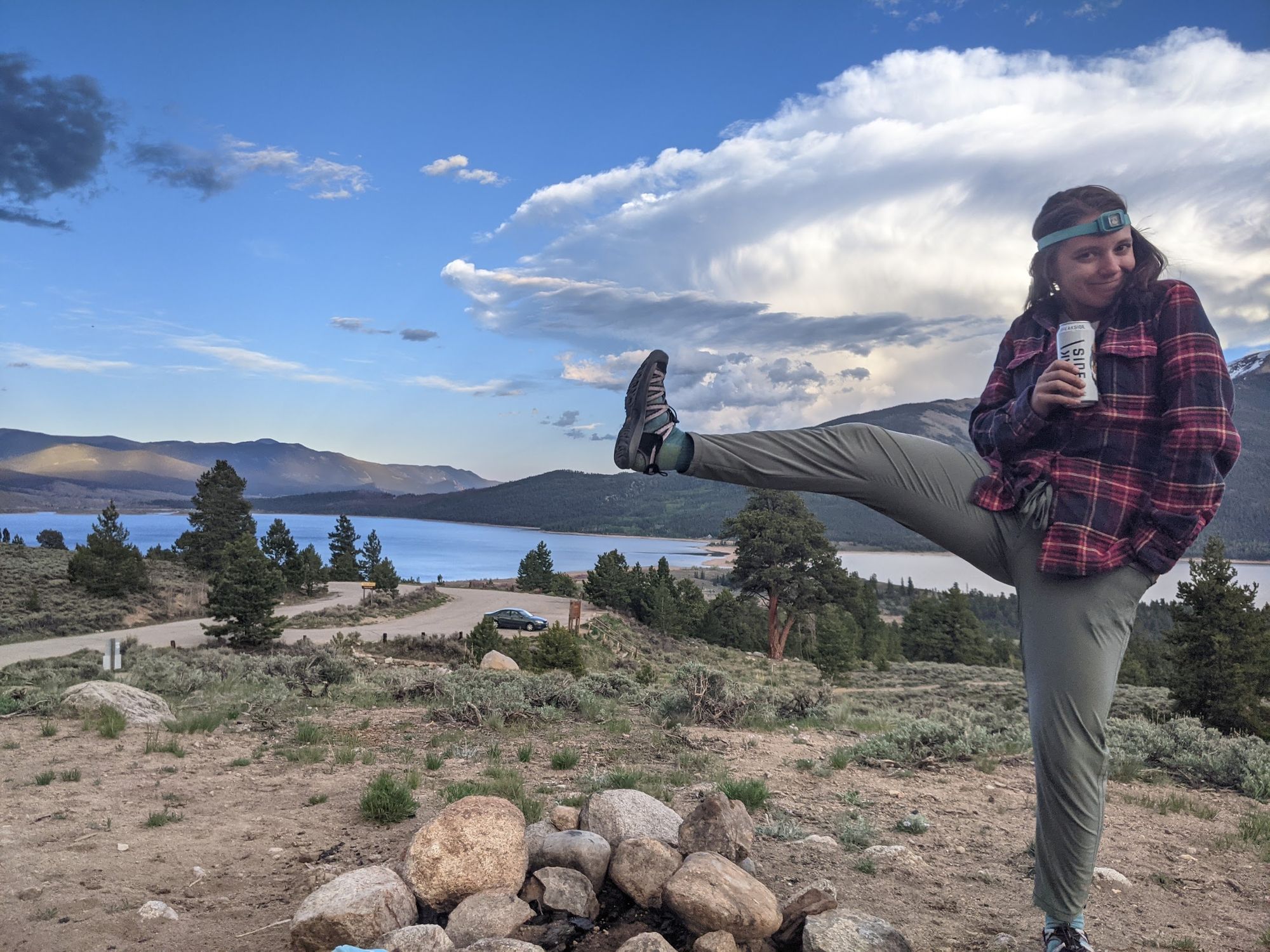
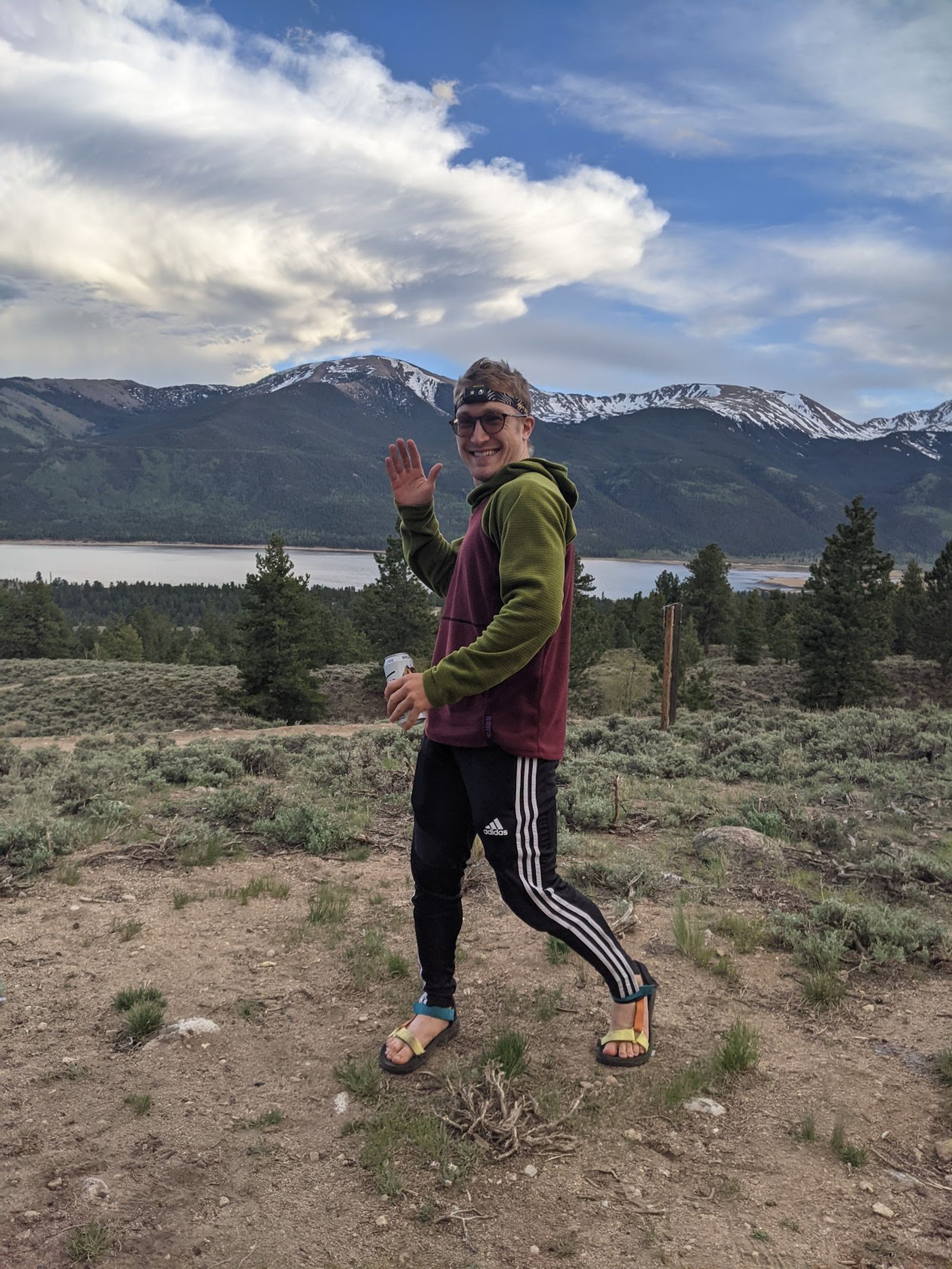
We were pleasantly surprised to find our preferred campground almost completely deserted. I suppose mose Coloradans were tuckered out from a Memorial Day weekend of maskless festivities. We parked, set up the tent at a beautiful overlook of the lakes, and attempted to work remotely. But the view was too damn good, so we tossed the laptops in the car and took the bikes out for a sunset spin.
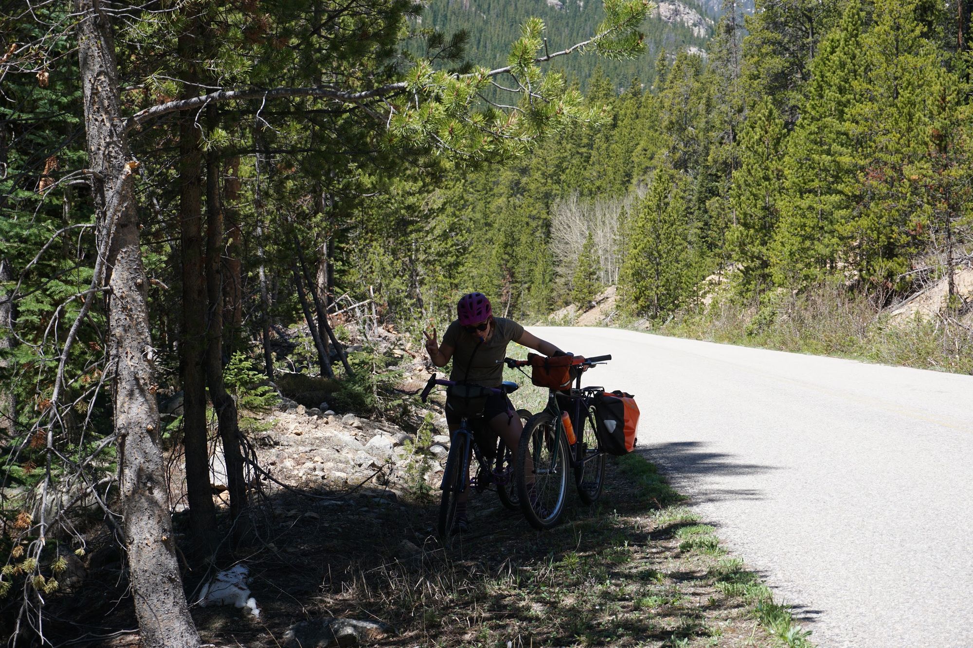
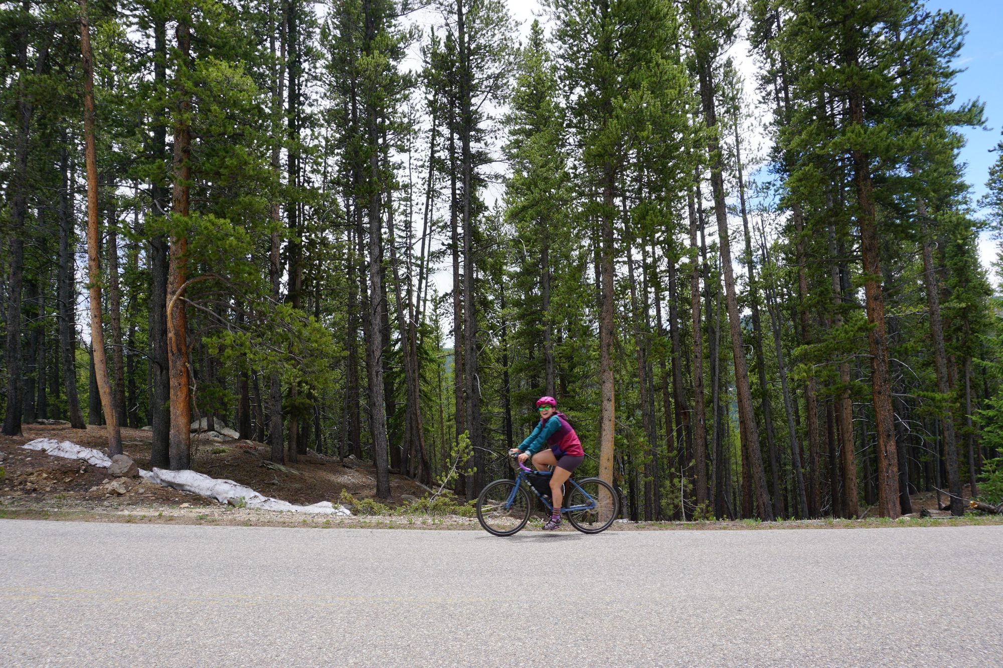
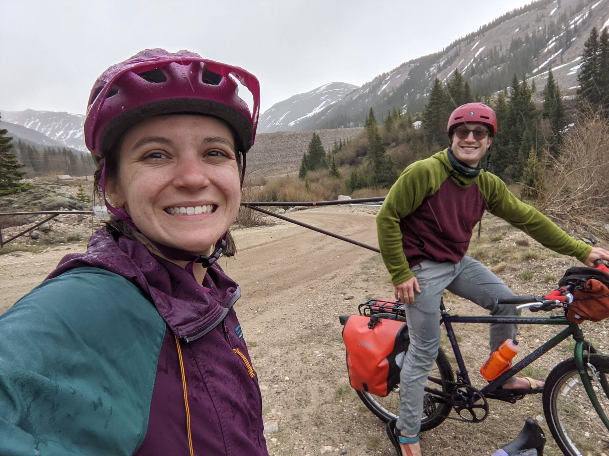
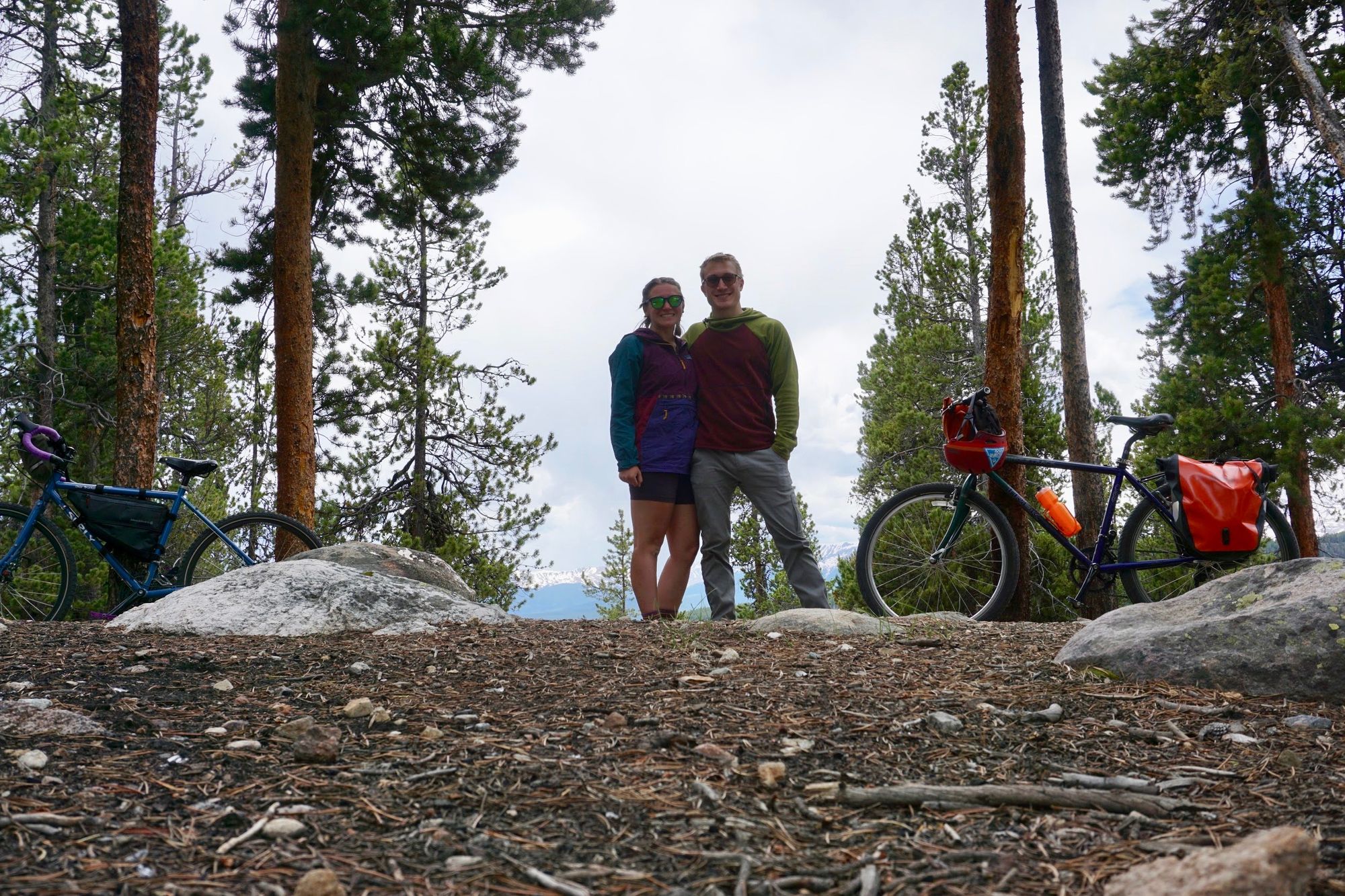
I've said this before, but let me remind you: Meg and I don't ride mountain bikes. Well, we don't ride modern mountain bikes, which come with dual (and sometimes triple!) suspension, hydraulic disk brakes, knobbly tires, and all kinds of fancy features that let you ride over rocks and bumps and other nonsense without vibrating your bones into dust. My bike, Mandarb, is a steel mountain bike from the 1990s with no suspension at all. Meg's bike, Sully, is basically a modern equivalent with better brakes. They've got chonky tires, but that's about it for mitigating bumps and rocks. Our bikes are awesome for pavement, dirt roads, gravel, and even some light singletrack. But they aren't exactly optimal for challenging mountain bike terrain like you'll find at ski resorts during the summer these days.

Of course, that didn't stop us from taking on 10% and higher grades on rocky, sandy roads near our campsite at the base of Mount Elbert, the tallest mountain in Colorado. But it did teach us some technical skills that came in handy for our long Saturday ride.
So we went on a nice (if steep) ride and were rewarded with sweeping views of Independence Pass, Twin Lakes, and the Collegiate Peaks. The ride down took almost as long, since we had to take those steep grades slowly, but it was beautiful riding through the aspens at sunset, so who can really complain. We got back to the campsite, whipped up some camp macaroni and cheese on our stove, and called it a night early so we could get the maximum amount of time on the bikes on Saturday.


The Saturday Loop
6:30 AM: We got up, made a quick double batch of camp oatmeal and aeropress coffee, and headed out on the first section of our ride: biking from Twin Lakes to Turquoise Lake.
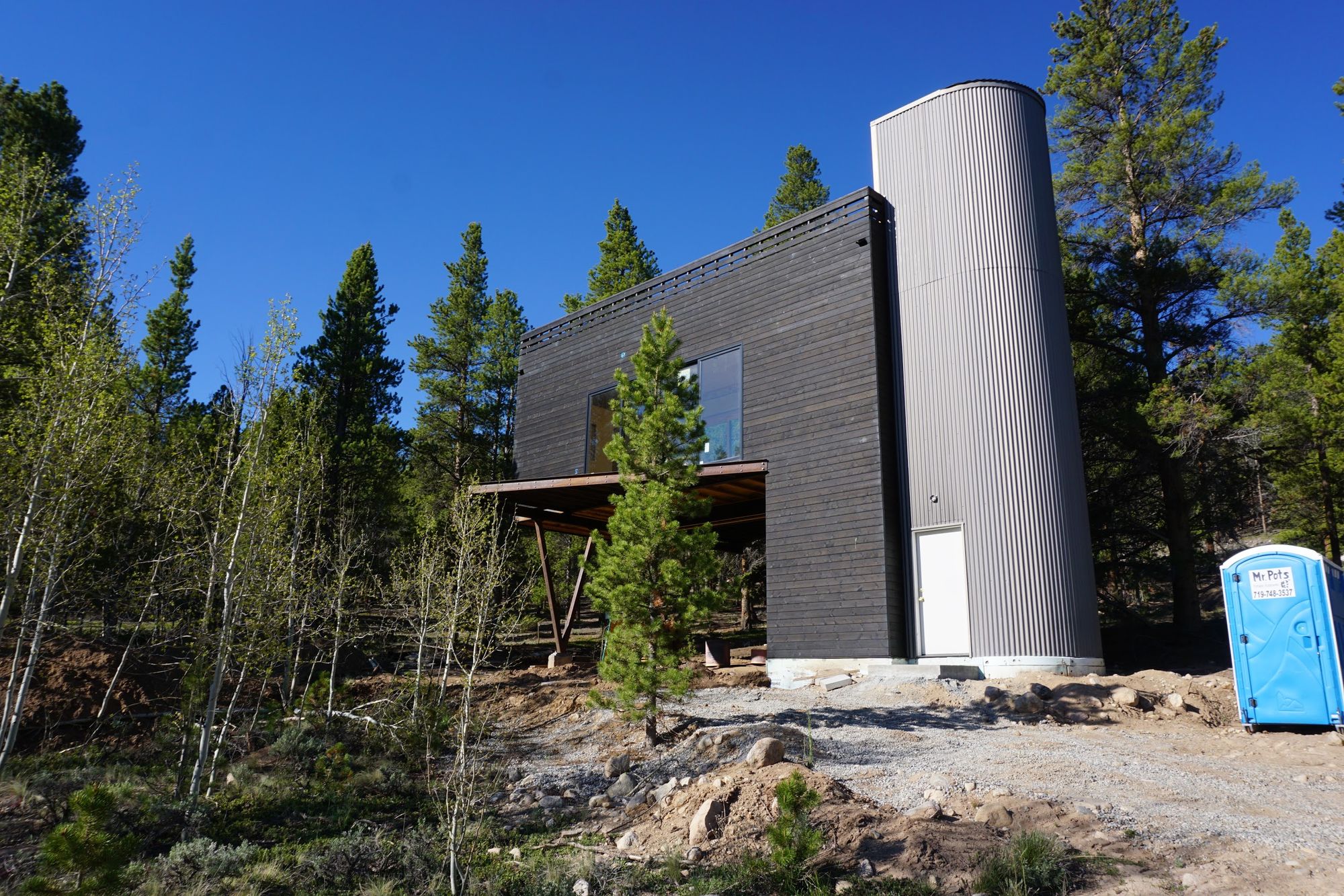
We started out on a surprisingly smooth paved road that snaked its way through even more campsites that I had possibly imagined existed by Twin Lakes. And then we saw one of the weirdest... houses? That I've ever seen.
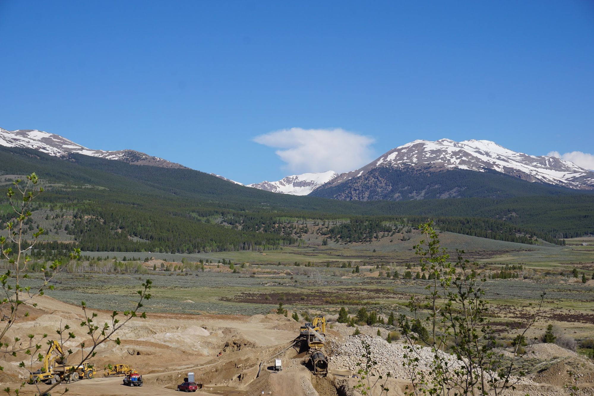
Soon the trail gave way to gravel as we passed a mine with views so nice, it made me consider working at a mine.
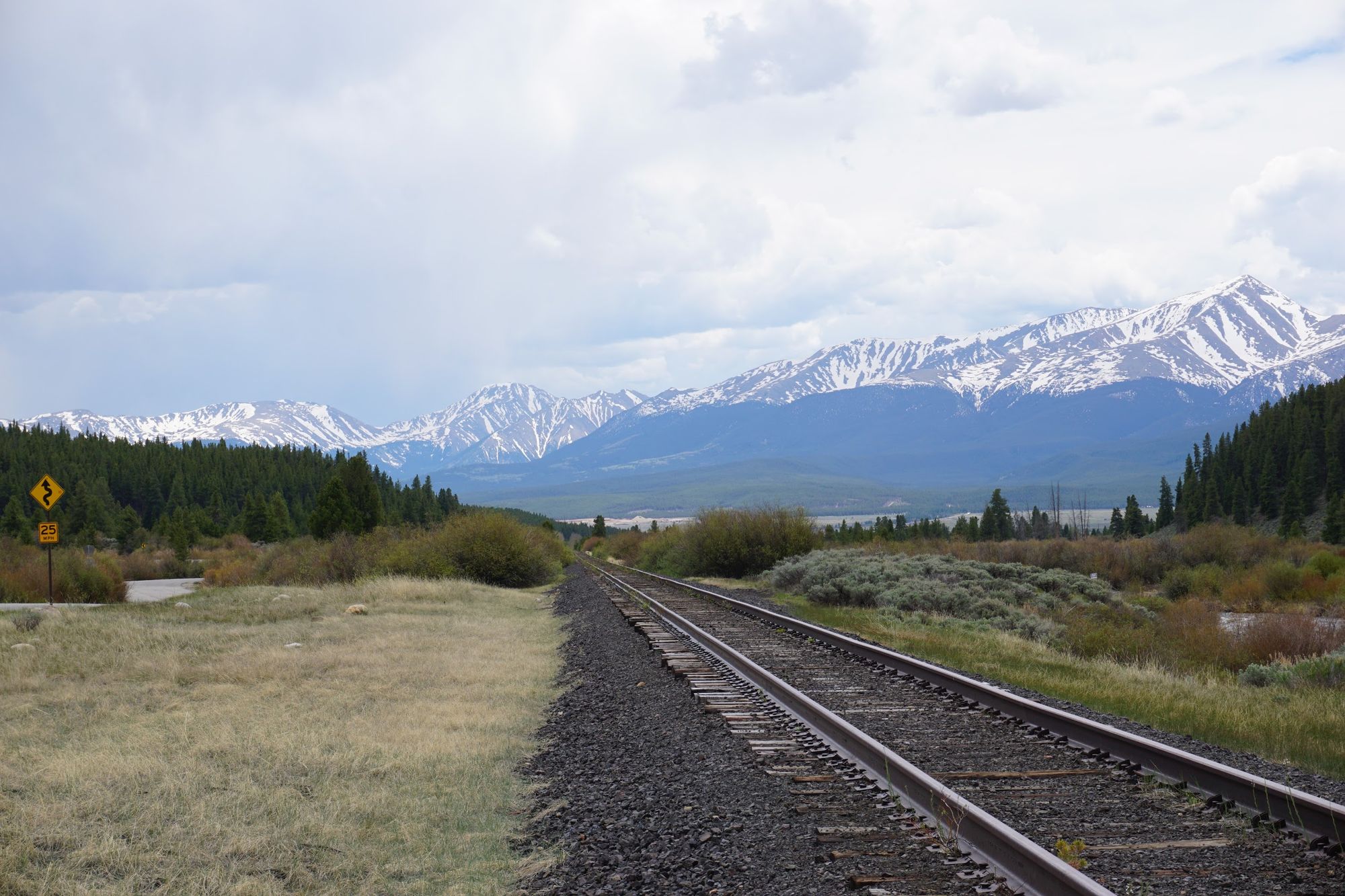
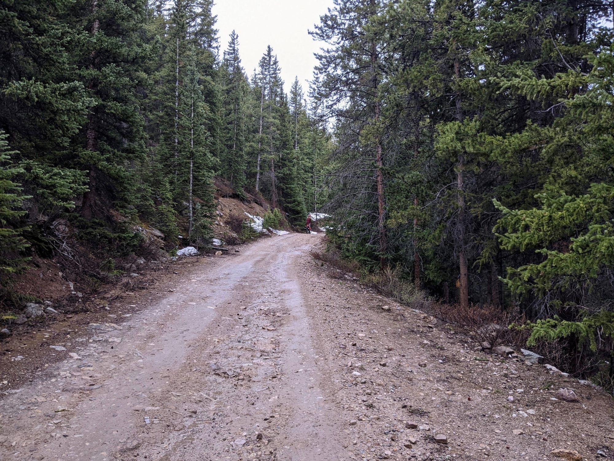
After a short time on gravel, we were back to the pavement and riding through ranch land. But it wasn't long before we made our way to a dirt seasonal road that really wasn't anything more than an ATV trail. (Sidenote: we'd later learn just what an ATV trail can be in the mountains. More on that later)
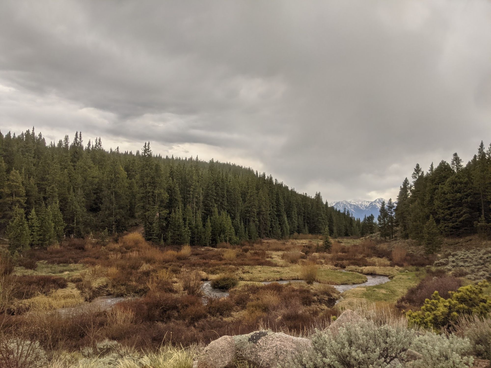
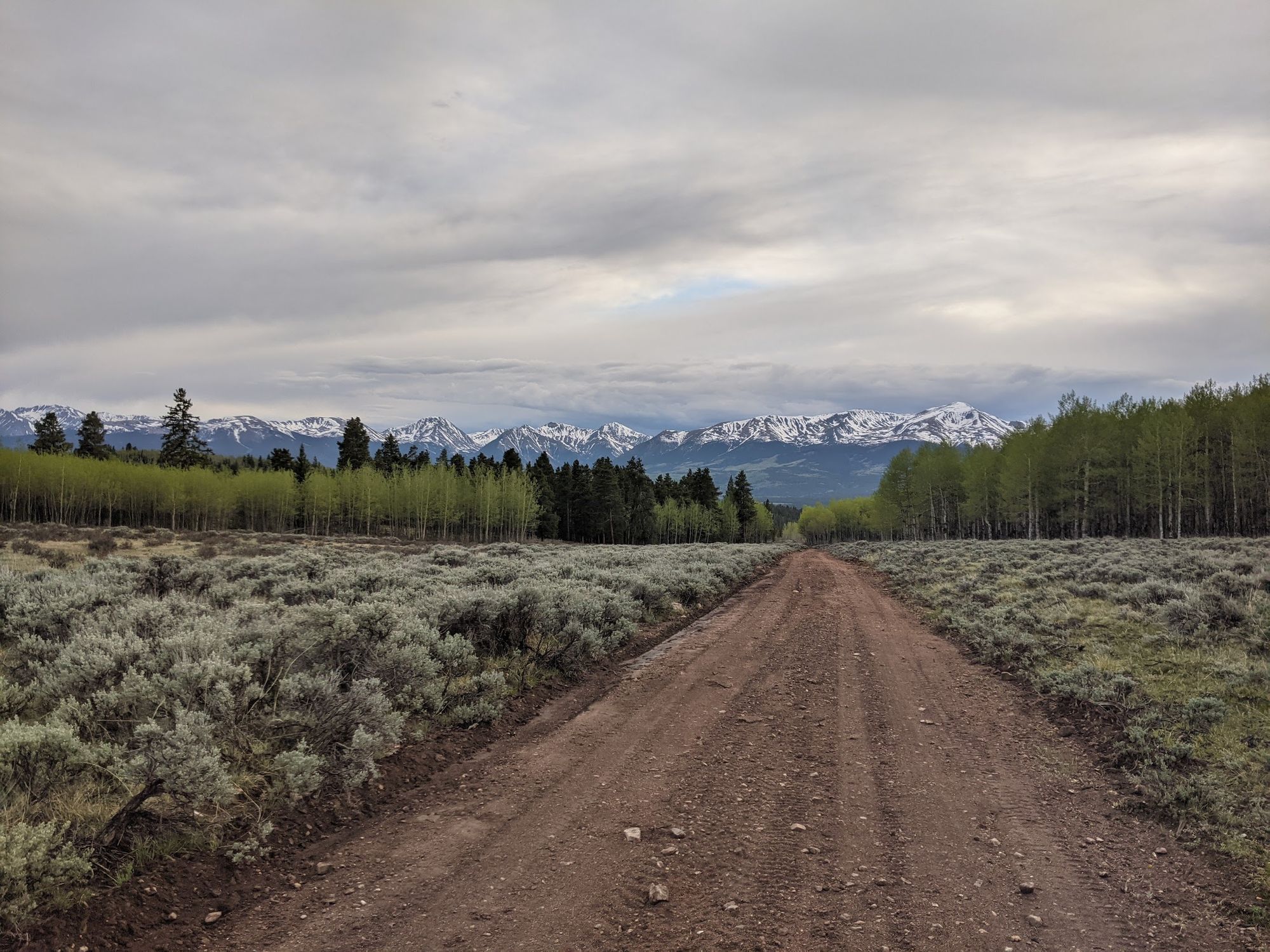
This ended up being my favorite road of the entire trip: just enough roughage of rocks and sand on the raod to keep things interesting, but generally smooth sailing, peace and quiet, and absolutely crazy views of the Mosquito Range on the eastern side of the valley. All we saw of humanity the entire time was one or two dirt bikes and perhaps one tent at a campsite.

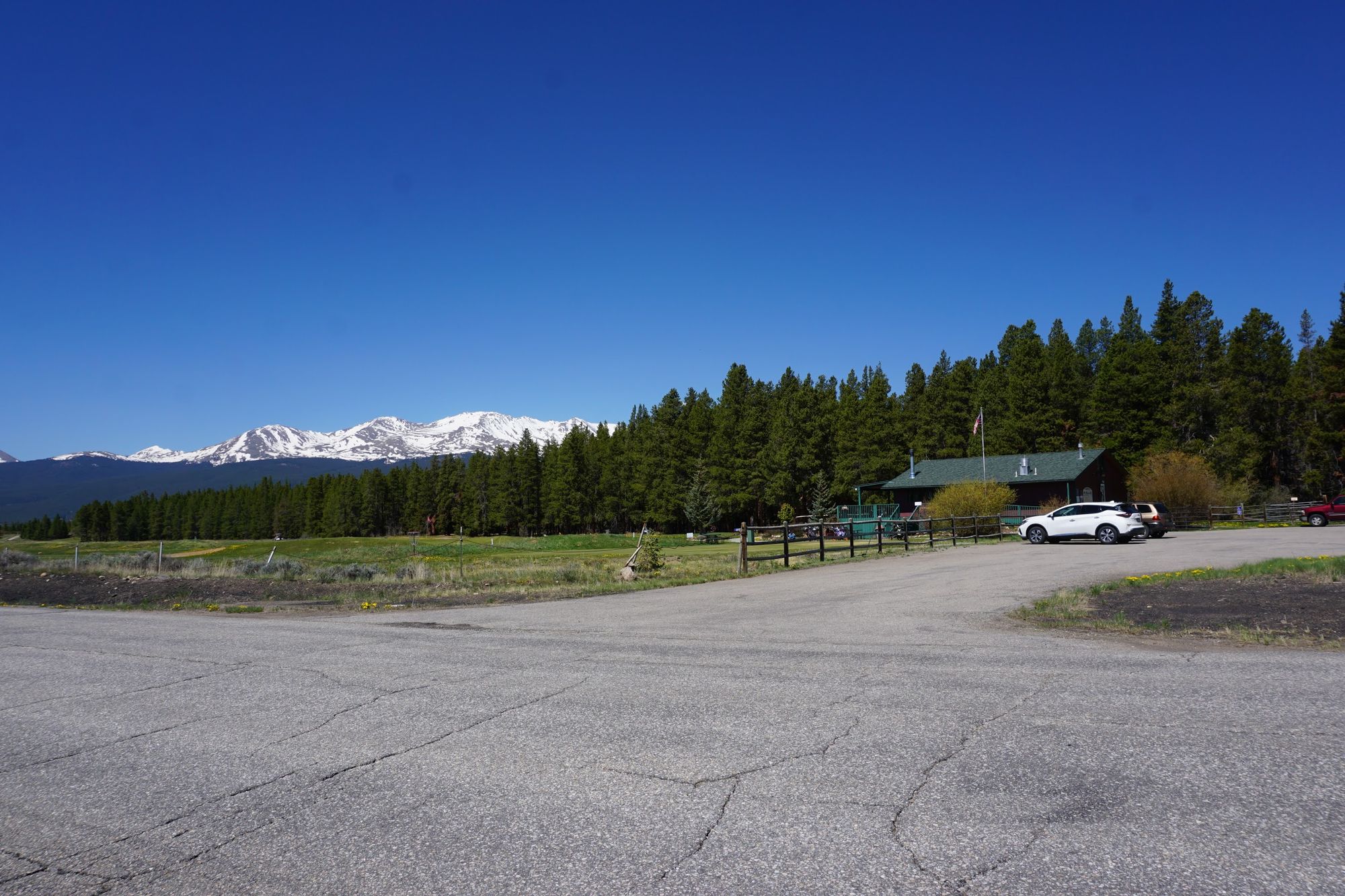
But the lazy dirt roads can't last forever. The last section of our trek to Turquoise Lake brought us back to paved ranch roads and past Mount Massive Golf Course, allegedly the highest altitude golf course in the US. A few more cars here, but not too many, and everyone passed us at a safe distance and speed.
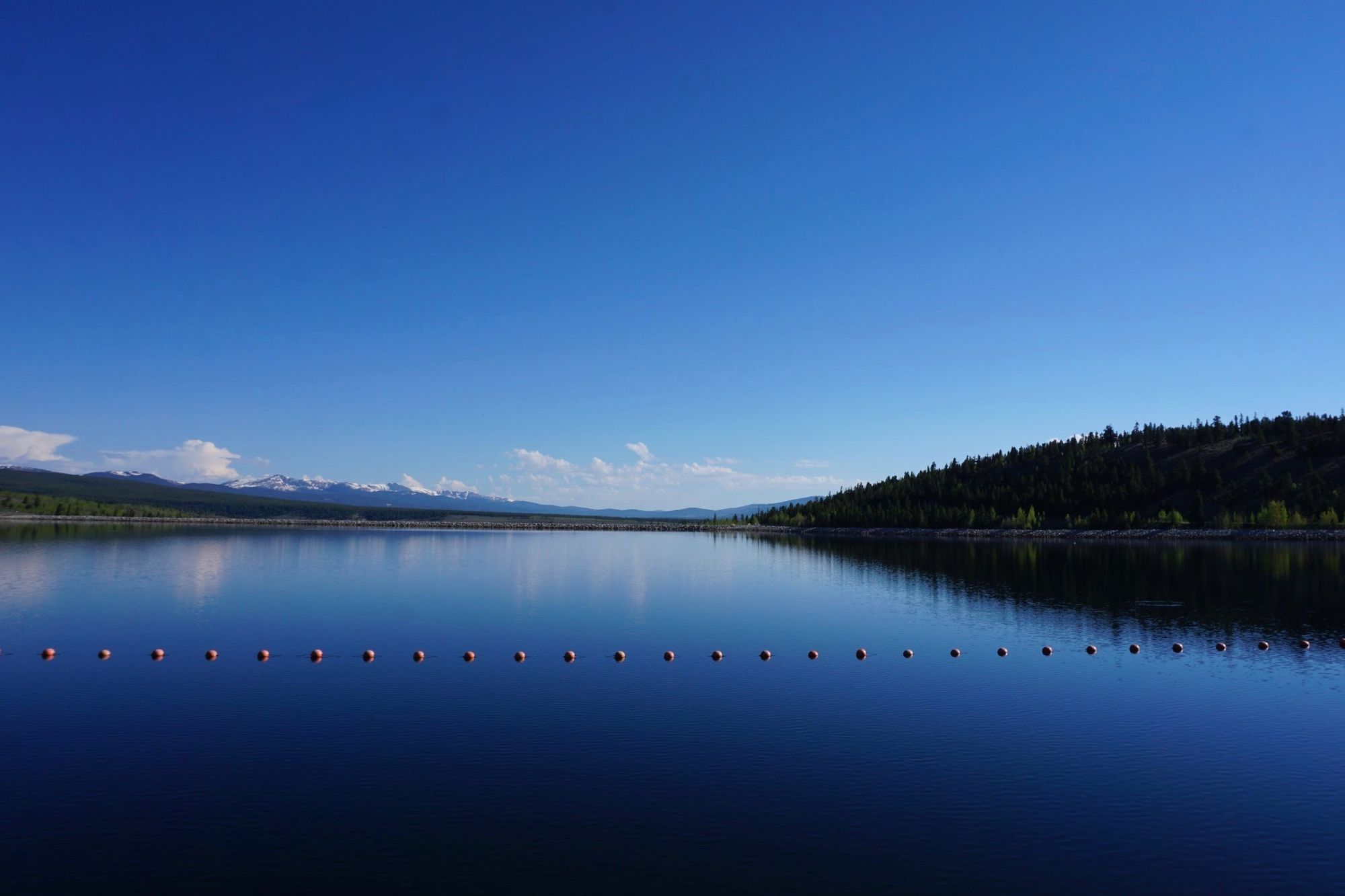
A short climb after the golf course, we reached Sugar Loaf Dam. Damn, it was beautiful. (sorry)

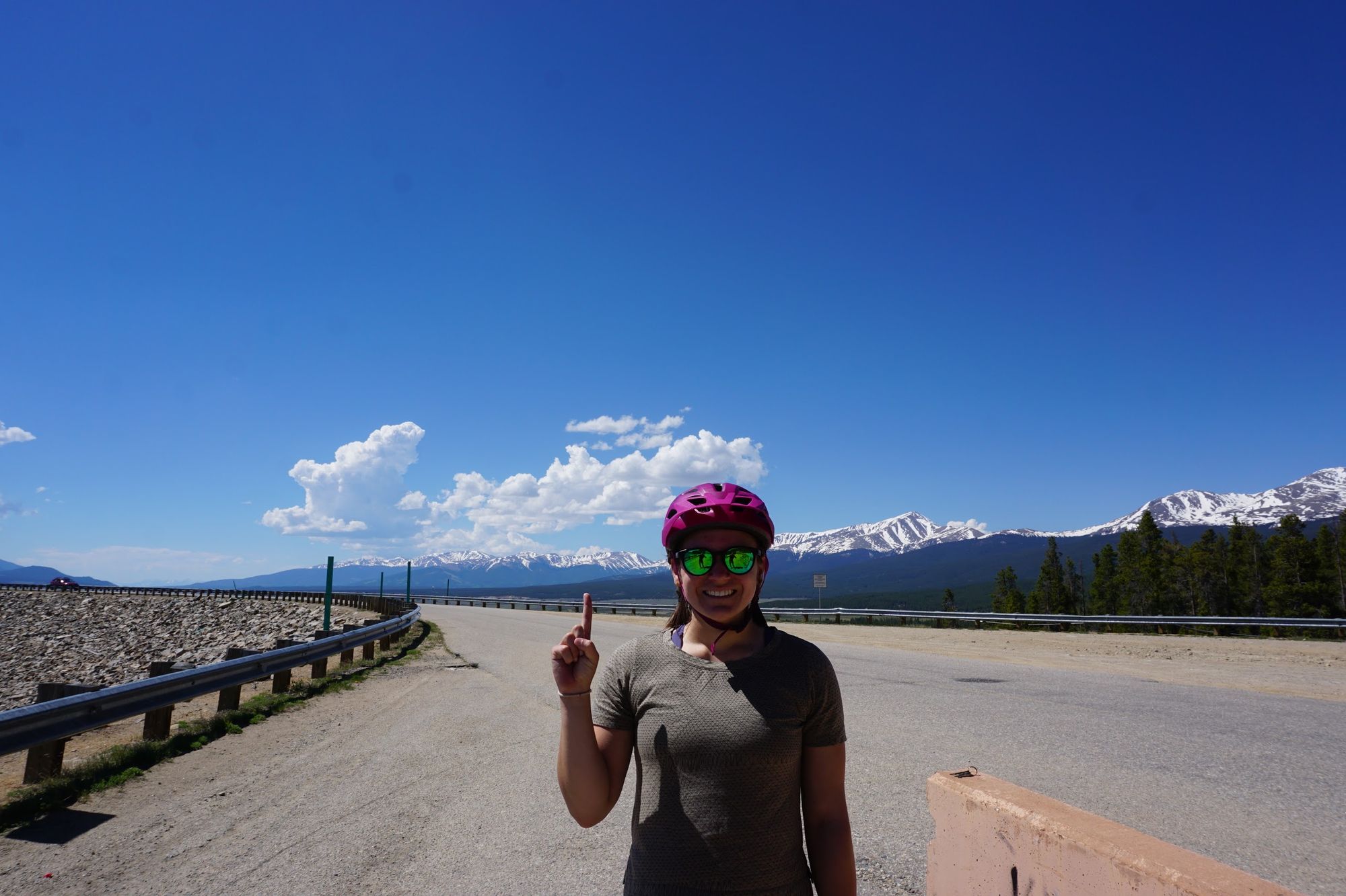
After a brief photoshoot and water break (hey, Colorado is hot and dry!), we started on the loop on routes 9, 4 & 9C around the lake. This was actually our second time around the loop -- we did the same trip on cross country skis back in March! The summer views are just as good, and biking is at least four times as fast as cross country skiing, but there was something special about the pure peace and quiet of snowbound Turqoise lake in winter. At least until the snowmobiles show up.
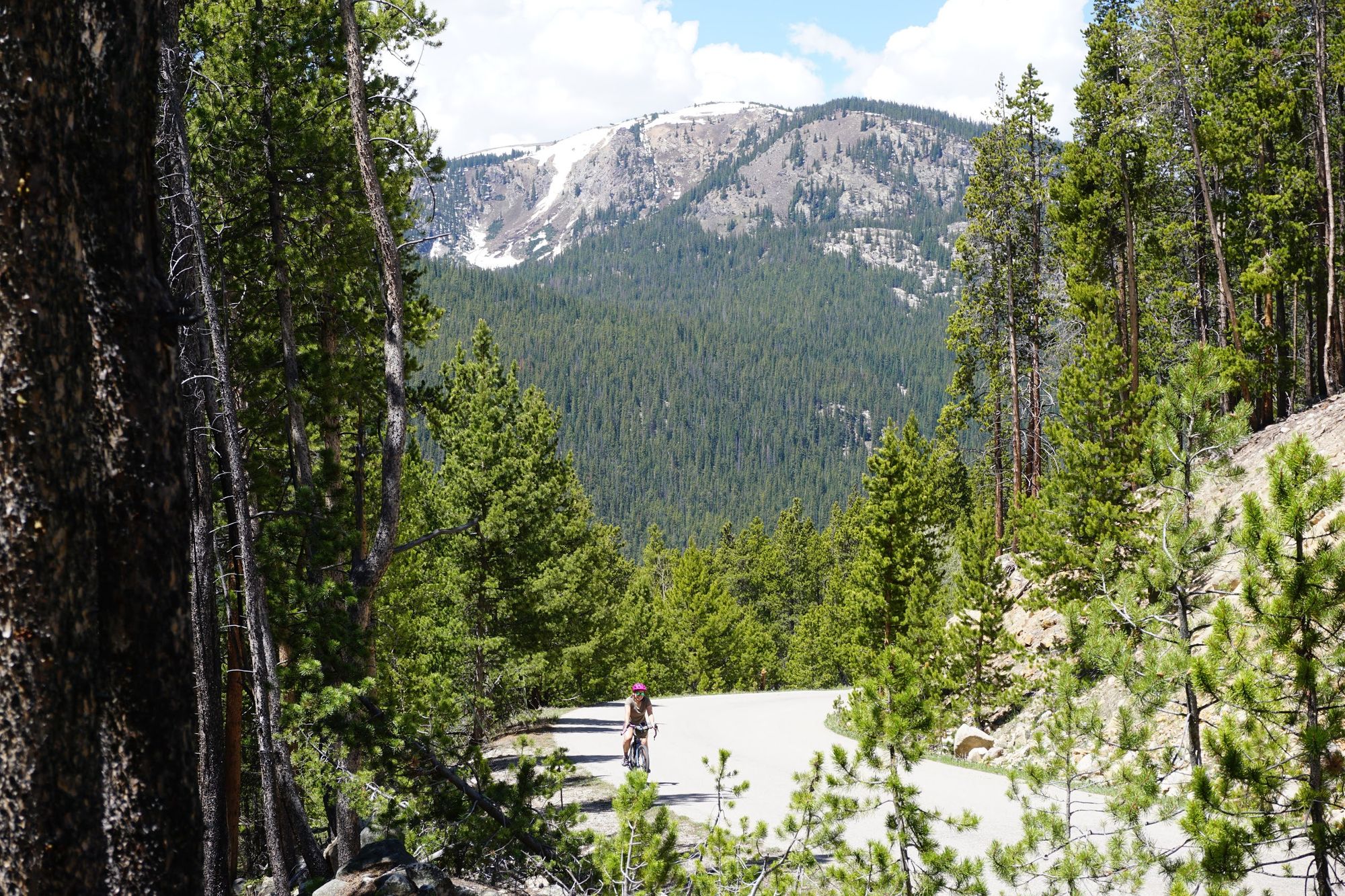
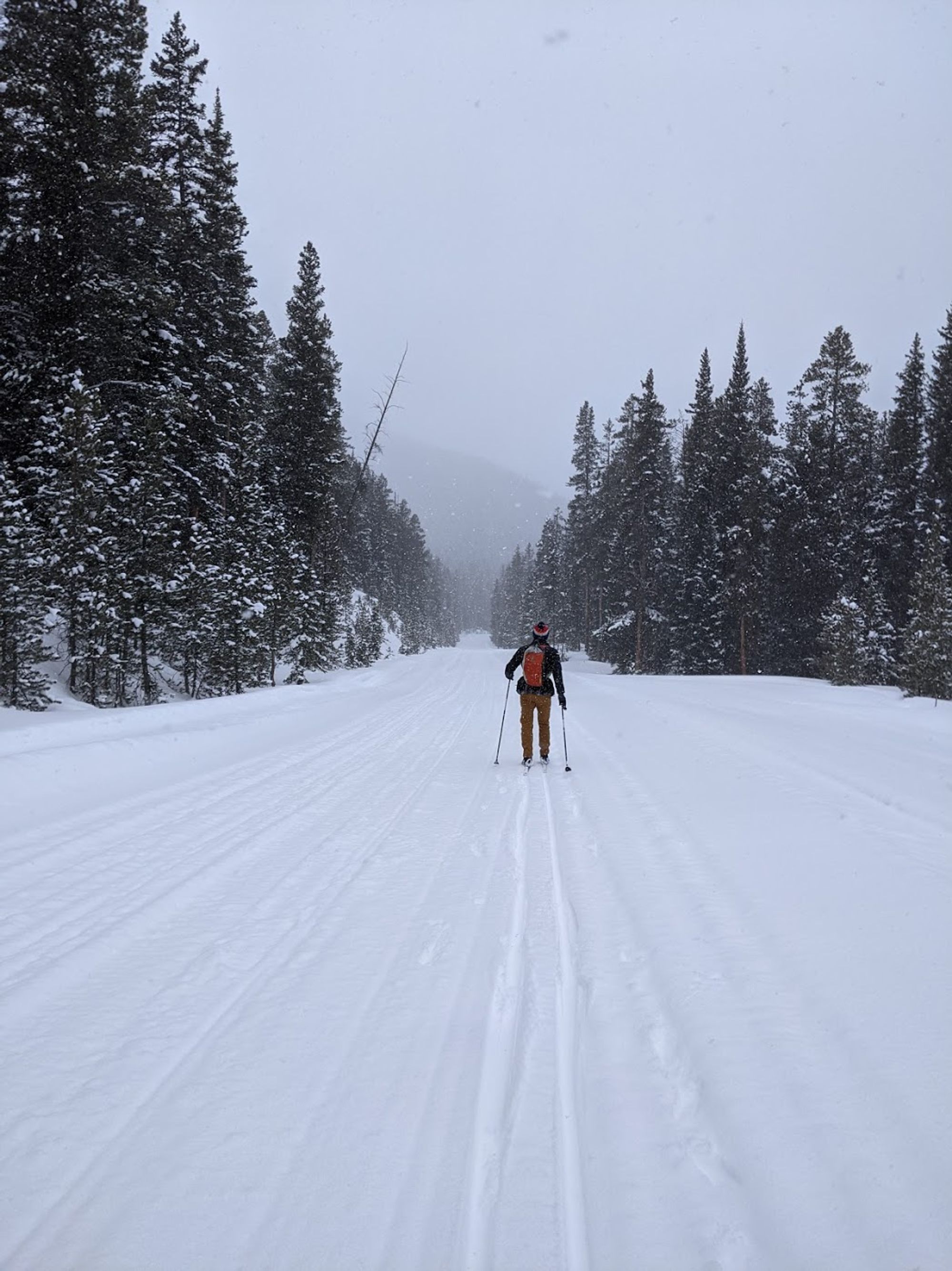
We rode up and down quite a few hills at Turquoise Lake, and at the very summit of the last uphill segment, we took the opportunity for lunch at Shimmering Point Overlook. This was actually the exact same spot where we lunched when we cross country skiied, though we had a better view this time since we weren't able to deviate much from the groomed trail in March.

Some hard kombucha, salami sandwiches, and cheddar bunnies (the store was out of pink goldfish, in my defense) later, we were on our way downhill, zooming through the last quarter of the lake loop at record speed. We checked out the other overlook points, but they were honestly just lower altitude versions of Shimmering Point with slightly worse views and some moderately fun gravel paths to bike on.
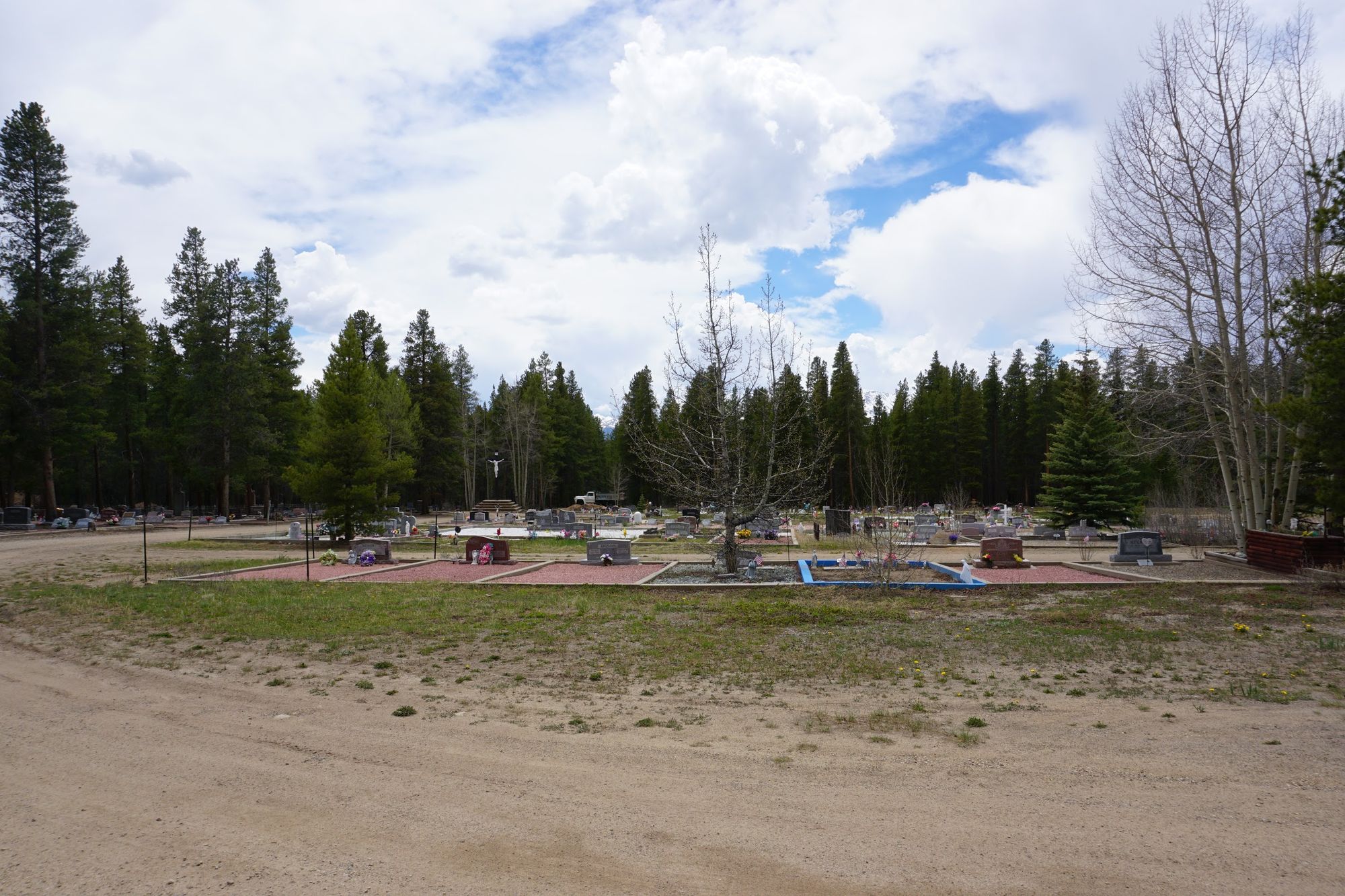
The downhill ride from our lunch spot brought us almost all the way to Leadville, where I found a nice gravel path along the side of the road and we checked out the very unusually organized Evergreen Cemetery, which is very... gridded.
After that quick stop, we headed over to the best brewery in Leadville, Two Mile Brewing Company. It's also the only brewery in Leadville (RIP Periodic Brewing). That's where we enjoyed a late lunch or maybe early dinner, depending on how you define eating at 3:30. A couple of beers, some sandwiches, and some potachos later, we engaged in a modest amount of touristing and stopped by Melanzana to nab some only-available-in-leadville hoodies.

After that, we were ready for the final segment of the ride, which I have affectionately dubbed...
The Meat Grinder
In my last post, I started to make up random names for rides. If I had to make up a name for our travels in the foothills east of Leadville, this would be it. It had it all: large rocks, great views, steep grades, rain, steeper grades, mud, steepest grades, and even some fun historical fact learning.
We began with a ride up out of town toward the Matchless Mine, where rich people decided to leave around a ton of old mining equipment when a mine stopped being profitable.
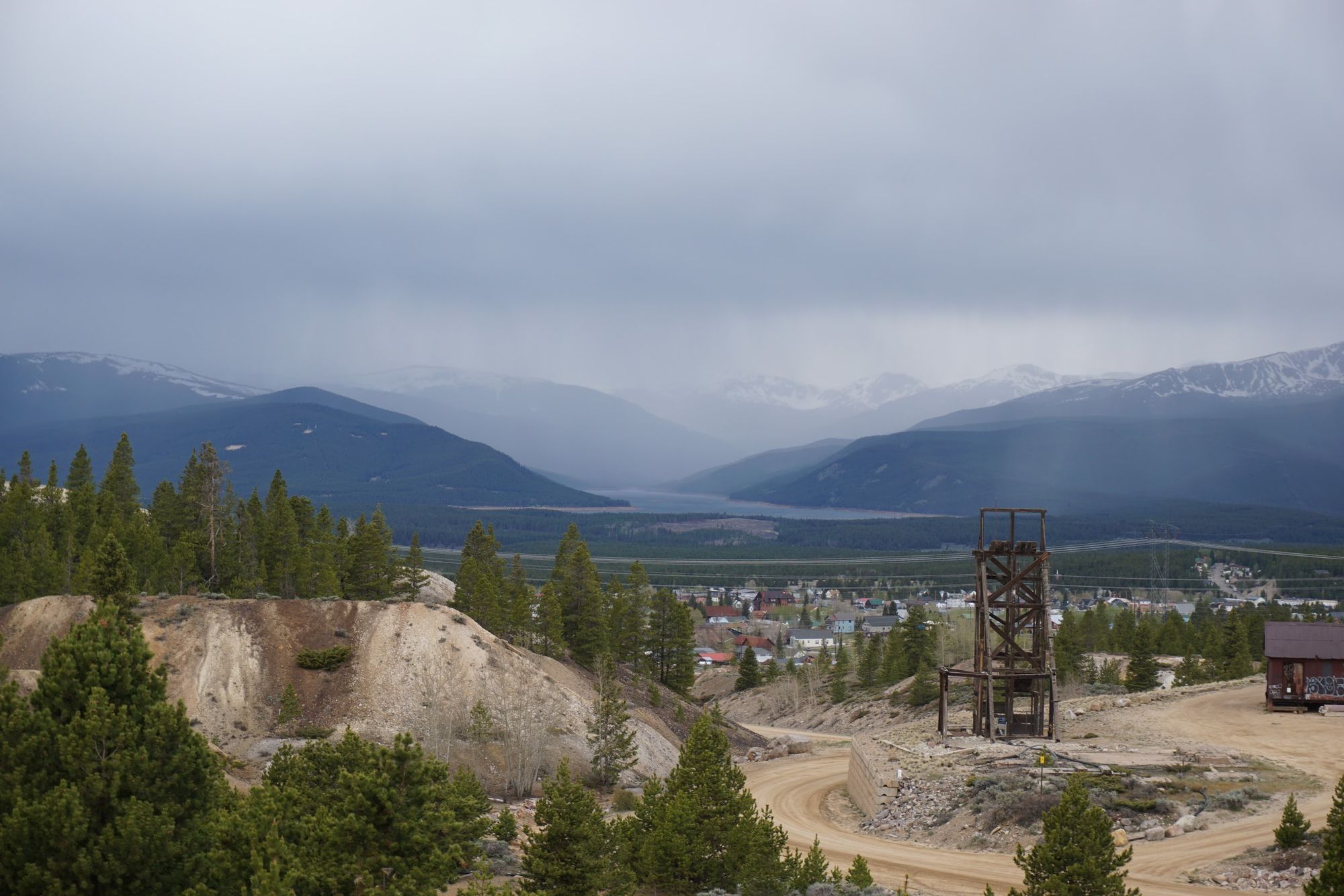
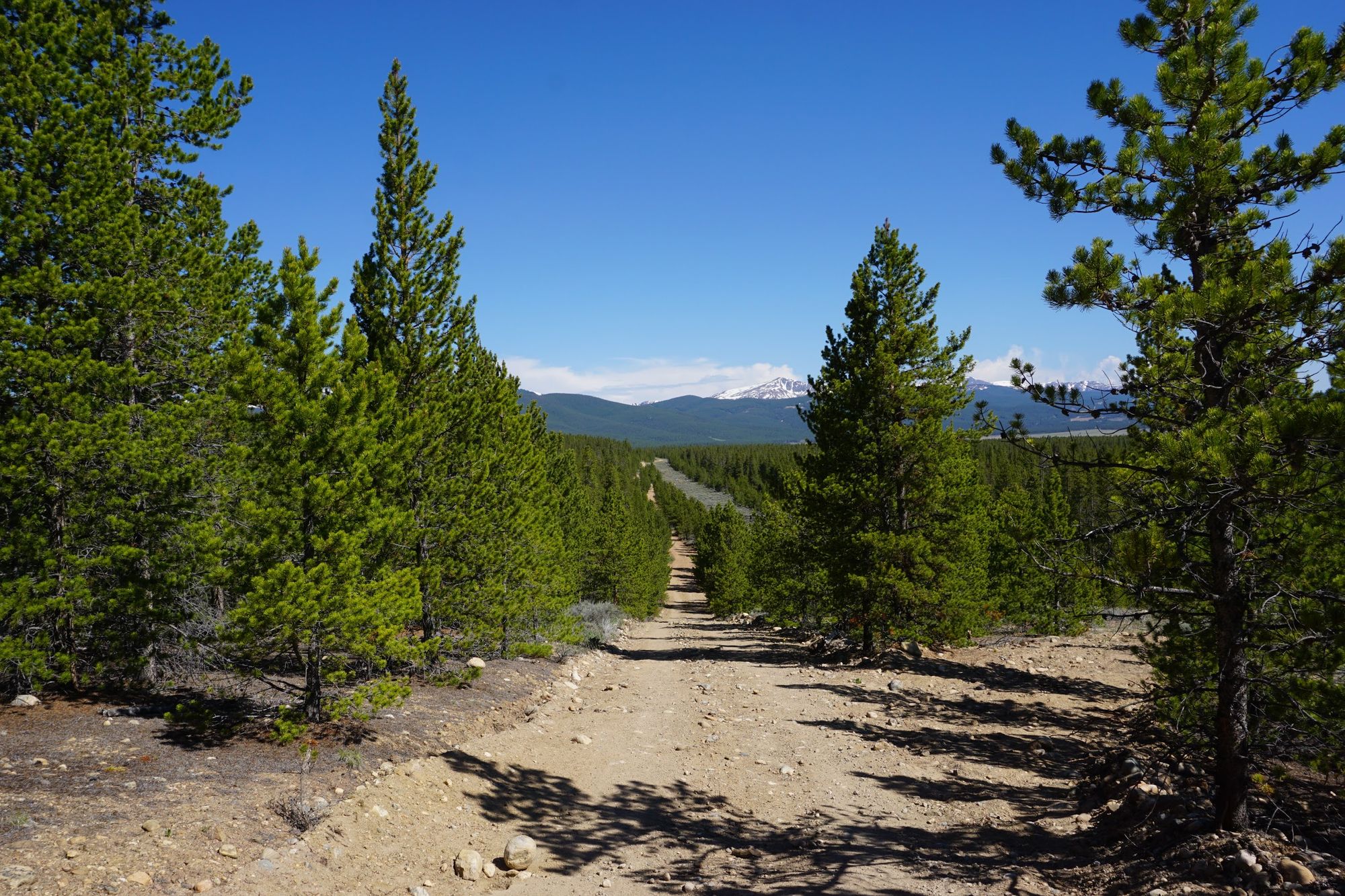
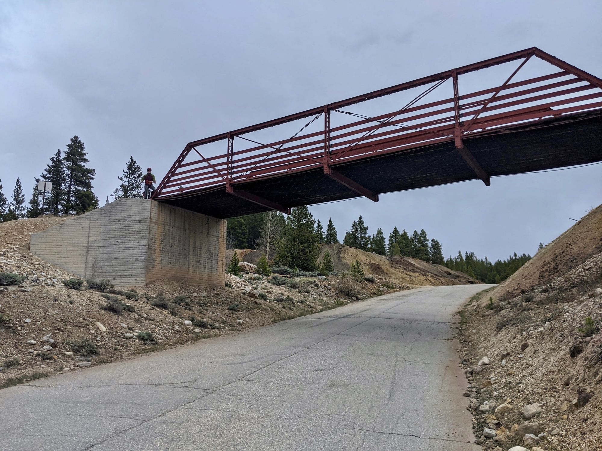
From the mine, we hopped on Leadville's Mineral Belt Trail, which was just as pleasant for bike riding in the summer as it was for walking and skiing in the winter. Very nicely paved, with great views, and almost too many plaques and historical facts. After the trail, we switched over to mountain roads in the foothills. That's where things got interesting.
The mountain roads of The Meat Grinder started off nice enough: next to no cars (perhaps two the whole paved segment), nice sealed pavement, decent grades. Then it started raining.
Then our path took us on a dirt road. Then that road was very steep. And very rocky. And wasn't really a road, but seemed to be an ATV trail dubbed the "Silverback Trail" that even a beefy, lifted 4x4 AWD vehicle would struggle with. But alas, we continued, preferring the quiet, technical roads to slogging down the shoulder of a 65 MPH highway.
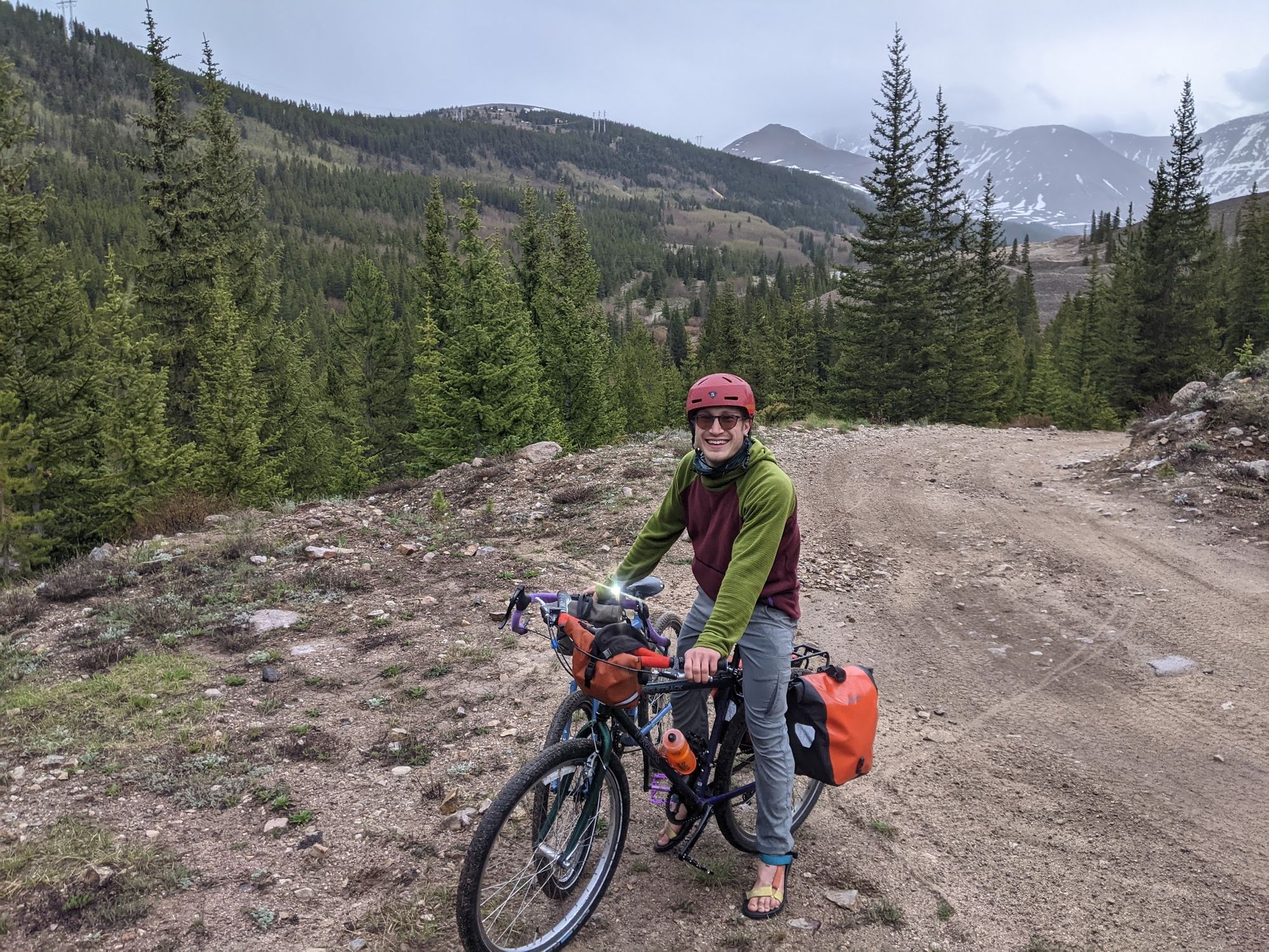
Then it was 7:30, and we realized we were still up in the mountain foothills, 15 miles or so from our campsite, with sunset looming at 9 PM. No problem -- we got out our bike lights for visibility, and picked up the pace a little, remaining cautious on the rocky downhills.
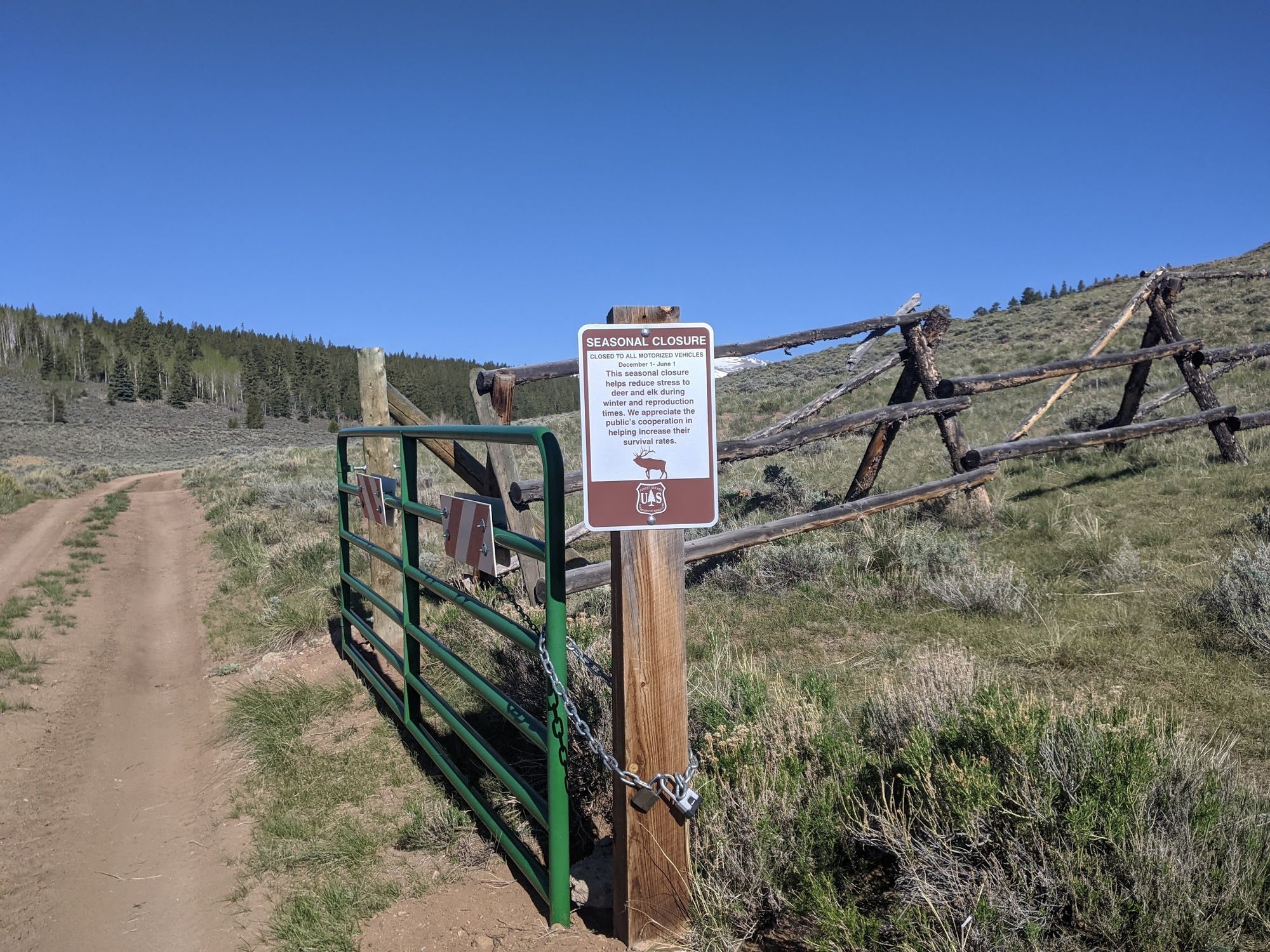
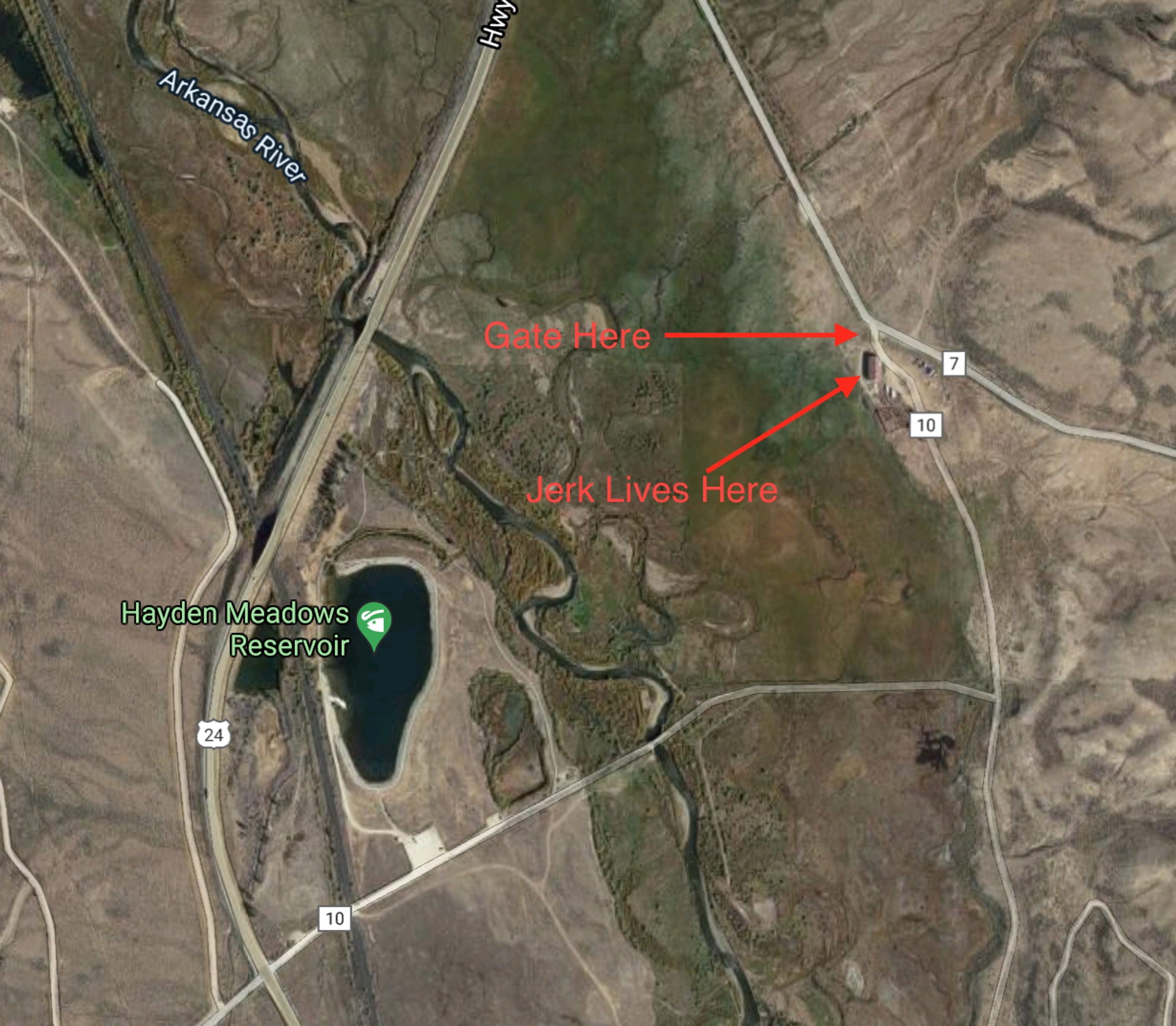
We reached a main-ish paved road around 8:45 and hit our next obstacle: a closed paddock gate. Even though we definitely didn't pass through any gates on our way there.
But fortunately the gate wasn't locked: it was just chained up. So we didn't have to do any fence or gate hopping. We made it onto the paved road without issue, carefully closing the gate for the next confused bicyclist.
But then Meg's front bike light died. No big deal -- I could just light the way for both of us with my front light, and it wasn't even dark yet.
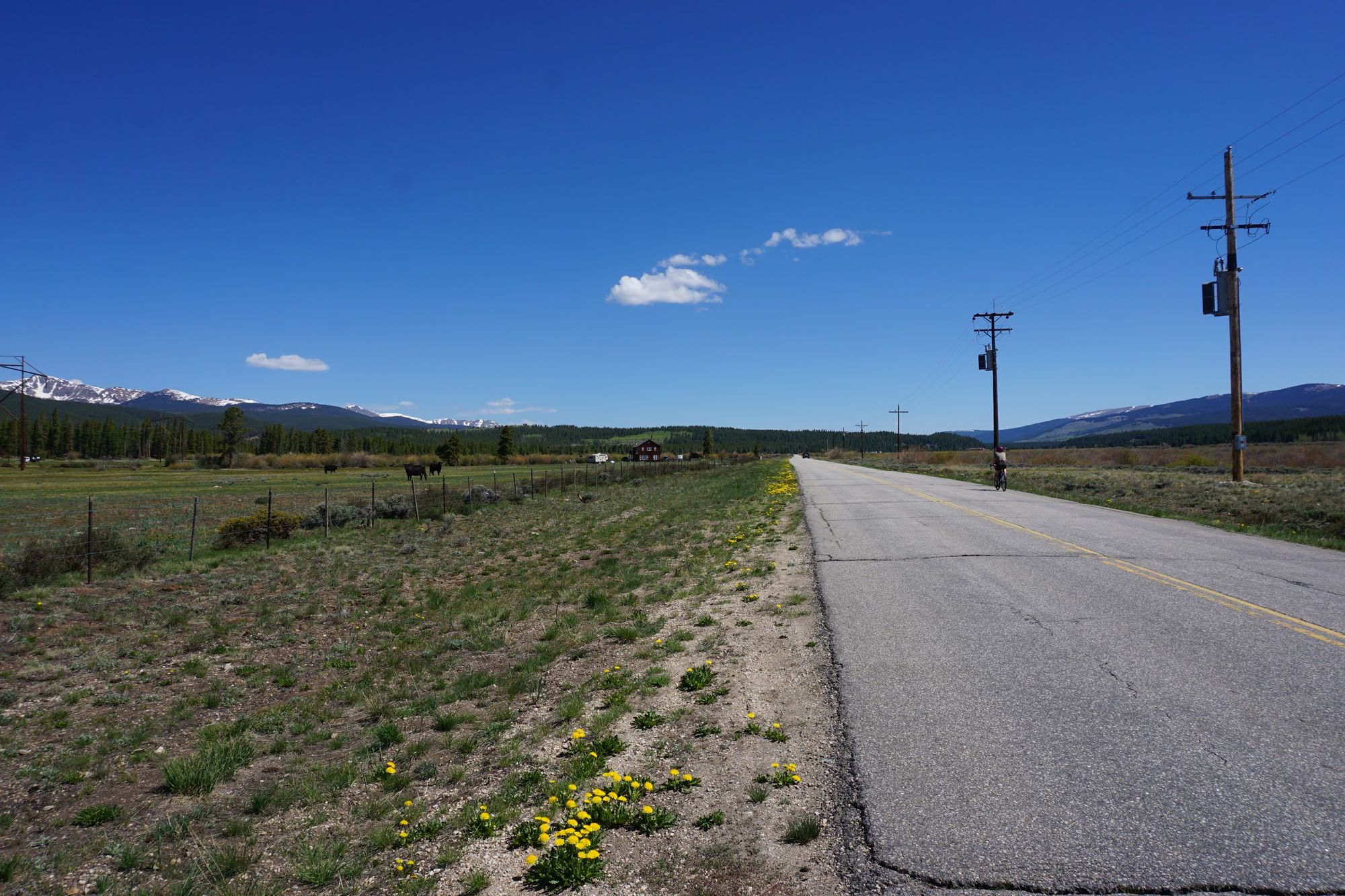
We headed down the road past some cute cows as the sun finally hit Mount Massive in the distance. And that's when we hit our next snag. We were supposed to take the next left to ride down an empty dirt country road, which would let us cross the 65 MPH highway instead of having to ride down it at all. But we somehow missed that turn. Some frantic map-consulting later, we decided to double back past the cute cows to try to find the dirt road to avoid riding on the highway shoulder.
That's when we found that the "country dirt road" was blocked by a rancher who decided that the through-road through his ranch was actually his private driveway. If the fence and the gate wasn't enough, the triple padlock setup convinced us to find another route. We sucked it up, turned around, and passed the cute cows for the third time. And we found ourselves, as darkness fell, riding 1.2 miles down the shoulder of a wet 65 MPH highway. I don't think I've ever ridden faster.
We made it down the highway with no real issues, and started back down the desolate paved ranch roads and the gravel mining road. That's when "dark" turned to "pitch black" and I realized that the moon was nowhere to be seen and cloud cover stopped any starlight from reaching the ground. Fortunately my bike light was fully charged and my panniers are very, very obnoxiously reflective.
By the time we made it back, it was truly dark night, our bikes were totally covered in mud, and all I wanted was to curl up in my sleeping bag. Of course, we still had to set up the tent (it gets windy in Colorado, so I wasn't going to leave it out all day), wash the mud off of ourselves, lock up the bikes, and make dinner. But after 60 miles and 6,000 vertical feet, that just didn't seem like much work in comparison.
Conclusion
Bike touring continues to be my absolute favorite way to explore towns and regions in Colorado. The ample dirt roads, beautiful views, bike paths, and feeling of exploration on the bike all combine to give a sense of accomplishment that's very different (and if you ask me, far superior) to hiking or driving around. You really get to know the lay of the land, and you can just take your time exploring an area. Just remember to charge your lights before each ride.
For our next adventure, Meg and I plan to finally load up the tent, sleeping bags, and other camping equipment on the bikes so we'll have everything we need right there on our ride. That way, we won't have to ride to any specific destination in the dark -- we can just camp whereever we want. No more forced nighttime highway rides!
Thanks for reading. If you have any suggestions or comments, send an email my way!
For those interested in our route, you can check it out here at ridewithgps.